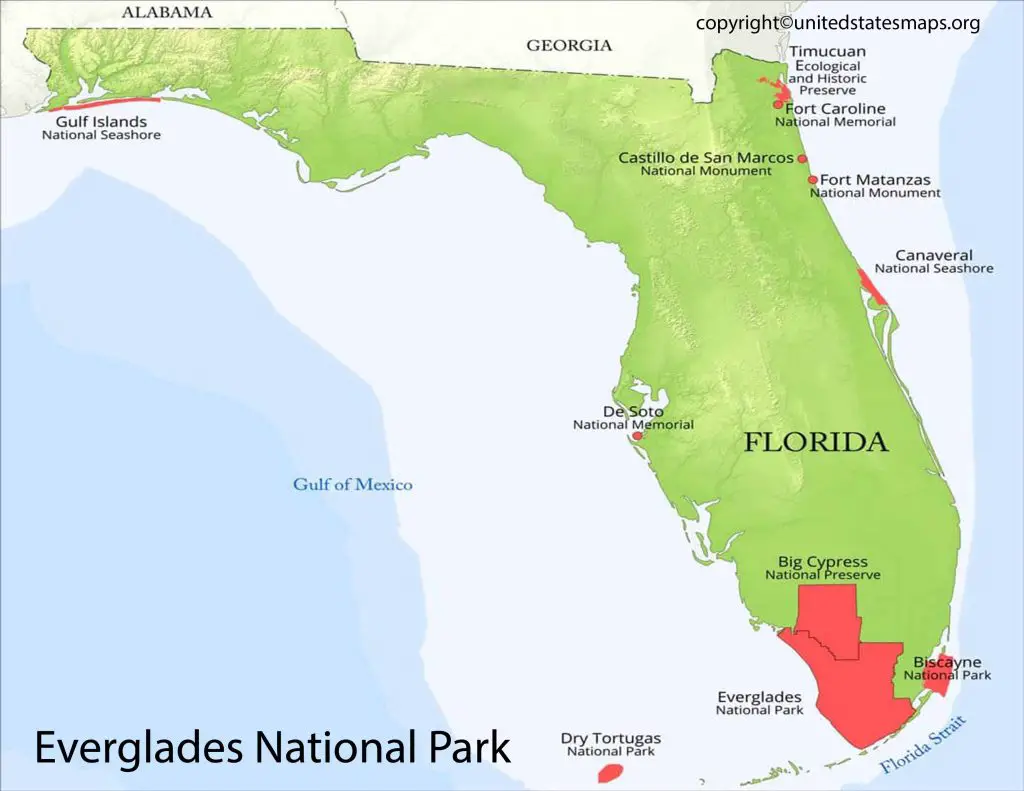
This Everglades National Park Map is a unique map document that is useful to guide any map reader to plan his/her visit to the park. It is the largest subtropical wilderness in the US. On average every year, the estimated tourist’s visit this amazing park about one million. This park recognized as a unique treasure boasting incredible sights, and activities filled with fun and dominated by some of the most fauna and flora on the globe. According to the map, this park full of historical wetlands, birds of many species, reptiles, and mammals that anyone can explore in several ways.
Check our other National Park related articles:
Everglades National Park Map
Everglades National Park a vast area of wetlands located in southern Florida. Spanning an impressive 1.5 million acres, the park established in 1947 to protect the fragile ecosystem and now designated as a World Heritage Site. International Biosphere Reserve, and Wetland of International Importance. A map of Everglades National Park can help you make the most of your visit, with its detailed layout and numerous points of interest for visitors to explore.

The park stretches from Lake Okeechobee southward to the Gulf Coast and includes. Coastal prairies, mangrove forests, cypress swamps, hardwood hammocks, pine rocklands and maritime strands. There are also over 300 species of birds that call this unique environment home. As well as numerous reptiles such as alligators and crocodiles.

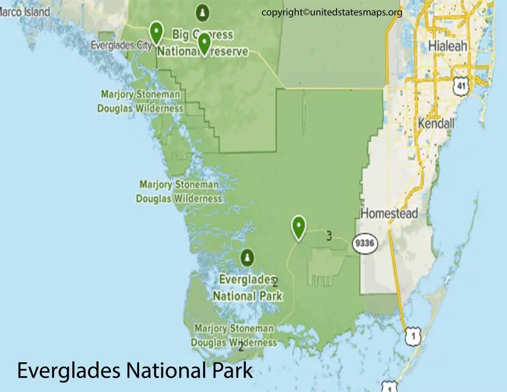
This national park map of the Everglades shows the three entrances to the park, which are identified in different cities, and hours away from one other. The main entrance of the park named the Ernest F. Coe Visitor Center. The second entrance known as, the Shark Valley entrance for visitors who are interested to observe the heart of the Everglades. Visitors from the Gulf coast can use the last entrance, which located south of Everglades city and close to Naples. Each entrance of everglades national park offers visitors unique features. That can help them to choose where to enter while planning their trip to the park.
Everglades National Park Trail Map
From the map of the everglades National Park, one can understand that this an American National Park. Meant for protecting the southern twenty percent of the original Everglades in Florida. It has the largest wilderness in the US, and the largest wilderness of any kind, east of River Mississippi. In the contiguous US after Yellowstone and Death Valley, Everglades ranked as the third largest park.
UNESCO distinctive the park as a World Heritage Site. The Everglades National Park is North America’s most necessary nesting habitat for tropical wading birds. It is domestic to the Western Hemisphere’s largest mangrove habitat. The park is domestic to thirty-six endangered or blanketed animal species.
This includes animals, like the Florida panther, and the American crocodile. Along with three-hundred species of birds of fresh and saltwater fish, forty species of mammals, and fifty species of reptiles. And then the majority of South Florida’s freshwater, which stored in the Biscayne Aquifer, recharged in this national park of Everglades.
Everglades National Park Boundary Map
The Map of Everglades National Park indicates that it consists of more than 800 square miles of marine water from the Ten Thousand Islands to Florida Bay. While operating a vessel in the water of the park, the visitor should familiarize himself with the system of the boat management zones of the park. These zones are known as, troll and pole zones. Other points the visitor while traveling on boats has to familiarize himself with channels. And navigational markers, and recreational opportunities available. This includes campsites that can enhance the visitor’s stewardship and enjoyment of the park.
Through this, the visitor can gain access to the latest information about the park waters. Visitors can also download the files of the latest Everglades National Park Boating Routes. And Zones with detailed Everglades National Park marine resource information including GPS locations. Of camping areas, zones of management, and channels of boating. A boater guide available about Florida Everglades National Park Map offers important information. For boating in the waters of the park from the City of Everglades to the Bay of Florida.
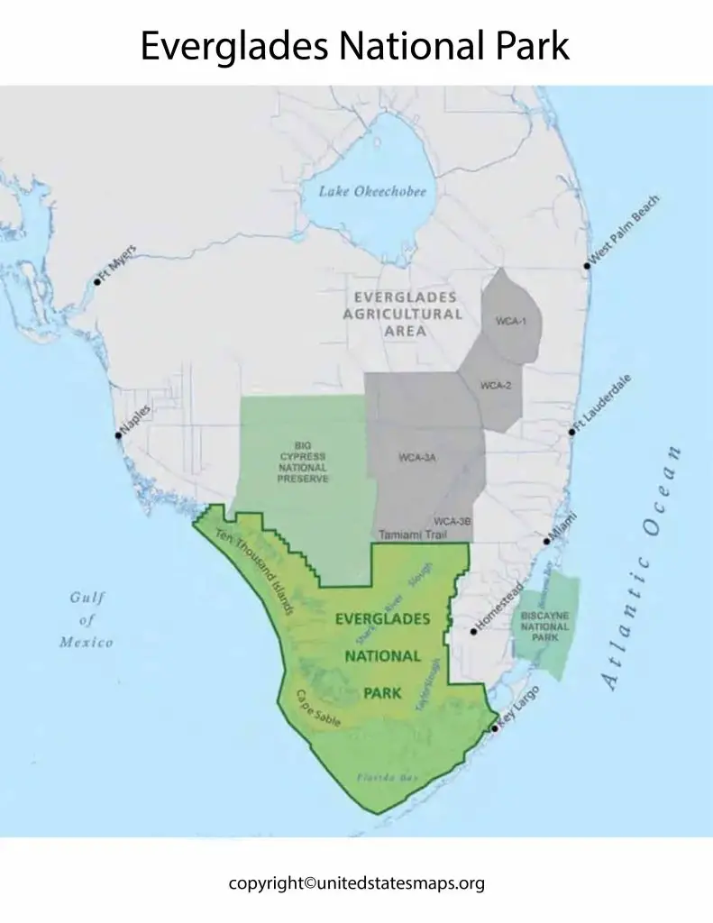
This covers all the locations consisting of camping sites, zones involving boating management, and useful channels of navigation. This guide produced in 2019 and a project of partnership between Everglades National Park authorities. And then the Florida Fish and Wildlife Conservation mission. But boaters can have paper copies of this guide enabling them to enter the main park station or at any of the park visitor centers.