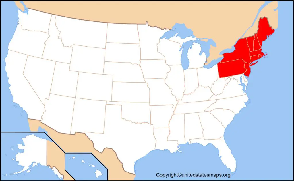
The Northeast US Map will allow users to gain an understanding of the geographic boundaries, major cities, and capitals of the northeastern part of the United States. This map offers a comprehensive view of the Northeast United States, suitable for students learning about the geography of the U.S., travelers planning a trip, or anyone seeking a printable map of the region.
The Northeast United States is one of the most crucial regions of the country and comprises states that have a history of importance, big metros, educational institutions, and economic influence. A Northeast States Map is a map that gives you information about the borders of the states in the northeastern part of the U.S., the major cities, and more.

What States Are in the Northeast Region?
A typical Northeast Region Map USA includes the following states:
- Maine
- New Hampshire
- Vermont
- Massachusetts
- Rhode Island
- Connecticut
- New York
- New Jersey
- Pennsylvania
These states can be divided into two sub-regions: New England and the Mid-Atlantic states. With a Northeastern United States Map, these are easily identified, and users can understand the part these areas play in the larger Northeast.
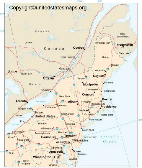
Northeast States and Capitals Map
A Northeast States and Capitals Map can be useful for many users to help them learn which capitals are located in each state in the Northeast. This map is particularly helpful for students, educators, and homeschoolers.
Some major state capitals in the Northeast include:
- Albany, New York
- Boston, Massachusetts
- Hartford, Connecticut
- Augusta, Maine
- Concord, New Hampshire
- Montpelier, Vermont
- Providence, Rhode Island
- Trenton, New Jersey
- Harrisburg, Pennsylvania
A Northeast US Map with Capitals makes it easier to study state locations and government centers across the region.
Northeast US Map with Cities
A Northeast USA Map with Cities highlights some of the most populated and influential cities in the country. Major cities commonly shown on a Northeast Region Map, labeled include:
- New York City
- Boston
- Philadelphia
- Newark
- Pittsburgh
- Buffalo
- Providence
- Portland
A map showing these cities can help travelers, researchers, and students better understand population distribution and transportation routes throughout the Northeast.
Printable Northeast US Map
Several visitors seek a Printable Northeast US Map which they can download and employ in their educational projects, classroom activities, travels, or perhaps for reference.
A northeast states map PDF is helpful because it can be printed out in high quality and used without the Internet. A Printable Northeast Map is frequently used by teachers as a way to teach about the Northeast, state identification, and labeling activities.
Blank Northeast Region Map
Blank Northeast Region Map is used in quizzes, worksheets, and for class assignments. Students can practice finding state boundaries, writing state names, and locating capitals without the capitals being labelled on the map.
One of the most popular PDF maps is a Blank Northeast Map that is utilized by teachers for geography lessons.
Political Map of the Northeast US
A PoliticalMap of the NE US emphasizes state boundaries, capitals, and significant population centers. This is a Northeast States Map Labeled for the identification of borders between states.
Political maps help learn about elections, government divisions, and administrative boundaries in the northeastern states.
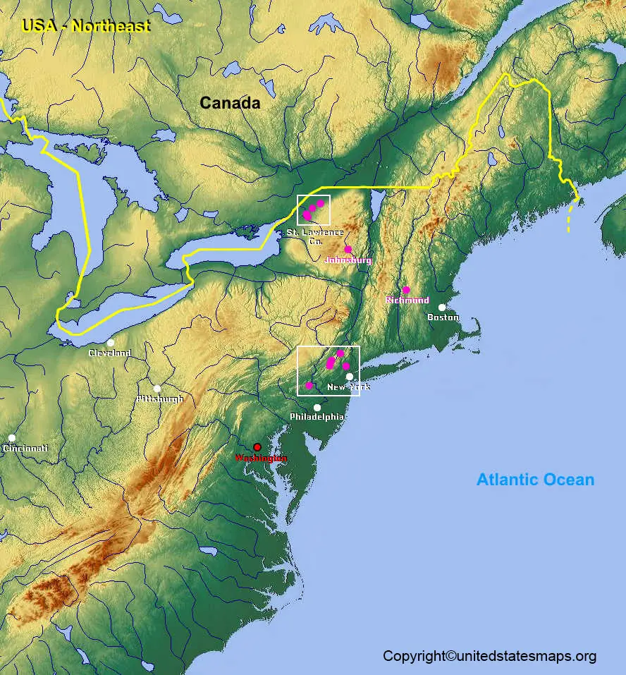
Road Map of Northeast USA
A Northeast US Road Map is often used by travelers when planning trips throughout the Northeast. A Road Map of Northeast USA shows highways, major roads, interstate highways, and transportation links between cities and states.
These maps are useful for planning driving trips and exploring places across the northeast US.
Difference Between New England and the Northeast
One common question is the difference between New England and the Northeast Region.
New England includes:
- Maine
- New Hampshire
- Vermont
- Massachusetts
- Rhode Island
- Connecticut
The broader Northeast region includes all New England states plus:
- New York
- New Jersey
- Pennsylvania
A Map of Northeastern States helps users visualize these distinctions and understand regional classifications used by educators and government agencies.
Why Use a Northeast US Map?
A Northeast Geography Map can help users:
- Identify northeastern states and capitals
- Study regional geography
- Learn state boundaries
- Locate major cities
- Plan travel routes
- Complete school assignments
- Explore the northeastern United States
Need a Northeast Coast Map, Northeast State Boundaries Map, Printable Northeast US Map PDF, or a detailed Northeastern Region of America Map? This resource offers geographic information for educational, travel, and research purposes.
FAQs
How many states are in the Northeast US?
The Northeast region typically consists of nine states: Maine, New Hampshire, Vermont, Massachusetts, Rhode Island, Connecticut, New York, New Jersey, and Pennsylvania.
What are the 9 Northeast states?
The nine Northeast states are Maine, New Hampshire, Vermont, Massachusetts, Rhode Island, Connecticut, New York, New Jersey, and Pennsylvania.
Where can I download a Printable Northeast US Map?
You can use a downloadable Northeast States Map PDF or a printable map version for educational and personal use.
What is the difference between New England and the Northeast?
New England includes six states, while the Northeast region includes those six states plus New York, New Jersey, and Pennsylvania.
Why is the Northeast region important?
The Northeast contains major cities, historic landmarks, educational institutions, transportation networks, and significant economic centers within the United States.
What are the largest cities in the Northeast?
Some of the largest cities include New York City, Philadelphia, Boston, Newark, and Pittsburgh.
Is Pennsylvania part of the Northeast region?
Yes, Pennsylvania is commonly included as part of the Northeast region of the United States.
What can I learn from a Northeast Region Map?
A Northeast Region Map helps users study state locations, capitals, major cities, transportation routes, and geographic boundaries across the northeastern United States.