US Highway Map displays the major highways of the United States of America, highlights all 50 states and capital cities. Highway maps can be used by the traveler to estimate the distance between two destinations, pick the best route for travelling. Highway maps are easy to use by a traveler. A highway map can be used to display roads and transport links rather than natural geographical information.
- US Voting Map
- US Climate Map
- US Pipeline Map
- Geographical Map of USA
- US surface Weather Map
- America Time Zone Map
US Highway Map
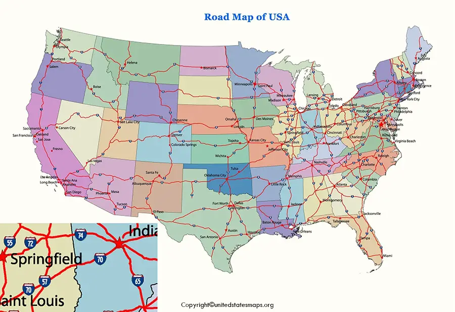
Highway Maps shows a particular highway in detail. Maps can help in choosing the, route to travel taking minimum time to reach your destination. US has a major interstate highway map which helps the citizens to travel from one state of US to another. Interstates access the roadways with no tolls and no stoplights.
Highway Map of USA
The US Highway map can be downloaded and can be accessed in determining the distance between two locations.
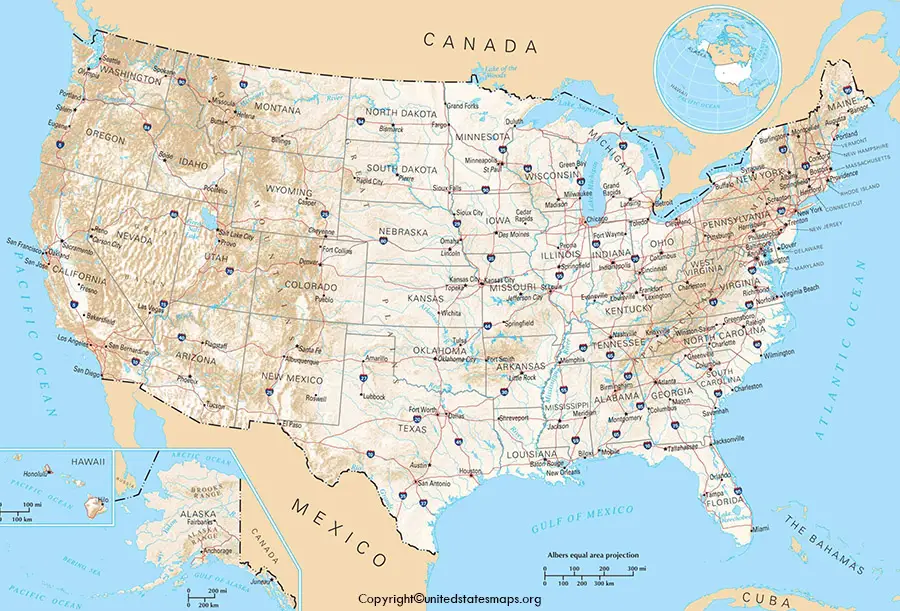
US Highway is an integrated network of highways within a nationwide grid of US. These are type of navigational map that commonly includes political boundaries and labels. The main characteristics includes distance, direction and area.
7 Major US Freeways includes
1: I-90 Seattle to Boston, 3,085 miles.
2: I-80 San Francisco to Teaneck, New jersey, 2,906 miles.
3: I-40 Barstow, California, to Wilmington, North Carolina, 2554 miles.
4: I-10 Los Angeles to Jacksonville, 2459 miles.
5: I-70 Cove Fort, Utah, to Baltimore, 2175 miles.
6: I-95 Miami to Houlton, Maine, 1892 miles.
7: I-75 Miami to Sault Ste. Marie, Michigan, 1787 miles.
Among all these the busiest highway in the US is I-90, covering a distance of about 3,085 miles ranked as the No.4 most traveled highway by the citizens and has recorded average traffic of 32,000 vehicles in a day. The Highway map of the 7 longest US Interstates can be downloaded below.
Printable Map of US Highways
A Roadmap can be used for automobile travel to reach a particular destination. The web-based road map software are used for marketing strategies by IT companies to provide data to an individual traveler to reach their location without any hurdles. Roadmap forces deep thinking where the individual wants to reach and helps everyone to stay on track.

The longest interstate map of the US is US-20, 3,365 miles and the shortest interstate map is I-375, Michigan. The longest and shortest interstate map of the US determines the area of the highways in miles. The US highway maps are helpful for the citizens for calculating the estimated time taken to reach their destination. The various interstate highway map help in connecting within the contiguous United States. The roadmap of the US can be downloaded from the below reference and can be used in accessing the destination.
Printable Road Map of US Highways
On the Map, Interstate highways are shown with bright red solid line symbol with an interstate shield label in it with limited highways and principal roads in fainter color. US Highway maps and Interstate maps have a slight difference, the one represents the connection between different
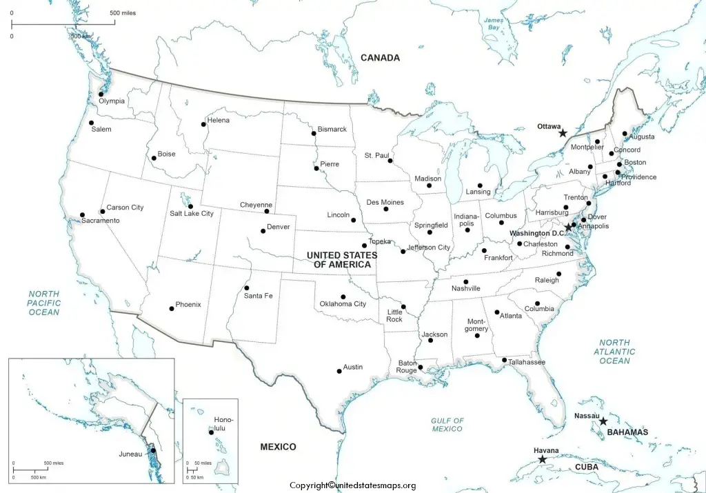
Metropolitan cities through the highway maps whereas the other represents the connection between the different states of the United States. The data furnished above is true, complete, and correct to the best of my knowledge and belief.
A U.S. Highway Map is a detailed graphical representation of the network of highways and major roads that crisscross the United States. It serves as an essential tool for navigation, travel planning, and understanding the connectivity between cities, states, and regions.
Key Features of a U.S. Highway Map
1. Highway Classifications
- Interstate Highways (marked with a blue shield symbol):
- Federally funded highways that form the backbone of long-distance travel.
- Numbering system:
- Even numbers: East-West routes (e.g., I-10, I-40).
- Odd numbers: North-South routes (e.g., I-5, I-95).
- Three-digit interstates are auxiliary routes, connecting to primary interstates (e.g., I-405, I-295).
- U.S. Highways (marked with a black-and-white shield symbol):
- Older national road system predating interstates.
- Numbering system follows a similar pattern (odd for north-south, even for east-west).
- State Highways:
- Roads managed by individual states.
- Numbered differently in each state and marked with unique symbols, often in a circle or square.
- County Roads:
- Local roads connecting rural areas to major highways.
- Usually not highlighted on national highway maps.
2. Symbols and Markings
- Major Cities:
- Represented with bolded names and symbols indicating metropolitan areas.
- Road Labels:
- Each highway is labeled with its official number.
- Junctions and Exits:
- Key interchanges and exit numbers are often highlighted on detailed maps.
- Rest Areas and Services:
- Locations of rest stops, gas stations, and amenities are often marked.
- Toll Roads:
- Indicated with special symbols or color coding.
3. Color Coding
- Interstate Highways:
- Blue or red lines, depending on the map style.
- U.S. Highways:
- Black lines or thinner red lines compared to interstates.
- State Highways:
- Often depicted in yellow or other distinct colors.
- Scenic Routes:
- Highlighted in green or another distinct color to indicate picturesque drives.
- Major Waterways and Terrain:
- Blue for rivers and lakes, shaded relief for mountains.
4. Geographical Features
- State and National Boundaries:
- Clearly marked to delineate jurisdiction.
- Points of Interest:
- National parks, landmarks, and historic sites often labeled for travelers.
Applications of a U.S. Highway Map
1. Travel and Navigation
- A primary tool for road trips and cross-country travel.
- Helps identify the shortest or most scenic routes.
2. Logistics and Transportation
- Used by freight and shipping industries for route planning and delivery optimization.
3. Emergency Management
- Essential for disaster response and evacuation planning.
4. Tourism
- Highlights attractions, national parks, and recreational areas.
5. Historical and Cultural Reference
- Reflects the development of the U.S. infrastructure over time.
Modern U.S. Highway Maps
With the advent of digital technology, traditional paper highway maps have been complemented or replaced by:
- GPS Navigation Systems:
- Real-time traffic updates and turn-by-turn directions.
- Interactive Online Maps:
- Platforms like Google Maps, Waze, and MapQuest offer dynamic mapping tools.
- Customizable Digital Maps:
- Allow users to overlay data like weather, traffic, or terrain.
The U.S. Highway Map is a testament to the country’s commitment to connectivity and mobility. It plays a vital role in the economy, enabling efficient movement of goods and people, and provides a practical guide for exploring the diverse landscapes and cultures of the United States.