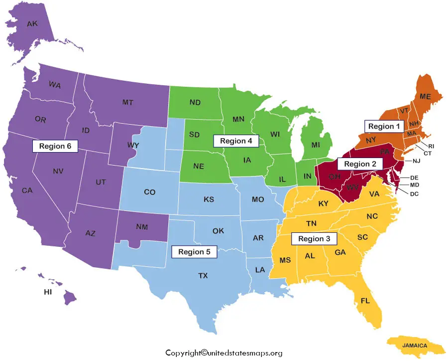
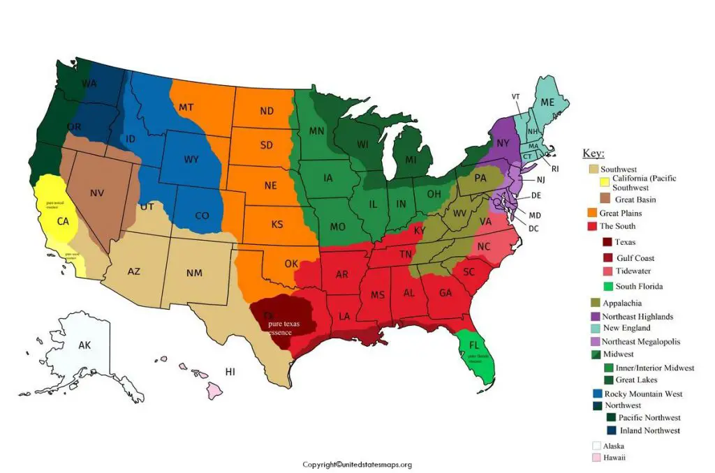
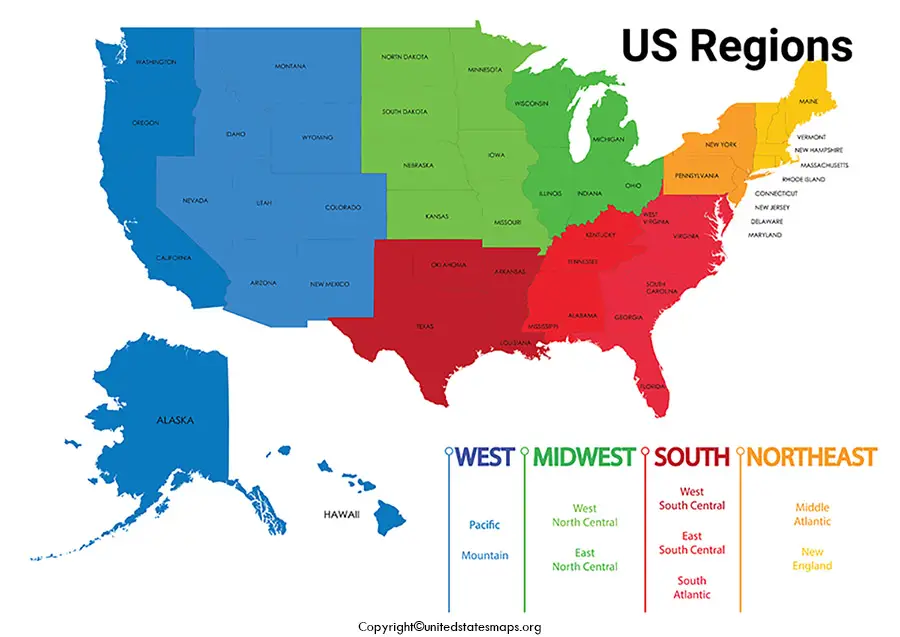
US Regions Map can be defined by natural features that include government, religion, language, forest, wildlife, climate. US regions can be divided into 5 categories according to their geographic position in the continent. Region Map shows boundaries between countries, states, and counties.
- US Voting Map
- US Climate Map
- US Pipeline Map
- Coronavirus US Map
- US Senate Map
- US Map with Capitals
- Interactive US map
- Map of southeast US
- Road Map of US
- Geographical Map of USA
- US surface Weather Map
- America Time Zone Map
US Regions Map

The US Region Map has been divided into five main regions which have different time zones, temperatures, climates and on the basis of geographical division, the region map can be used for further reference.
The five regions include:
- The Northeast Region
- The Southwest Region
- The West Region
- The Southeast Region
- The Midwest
The main five Region maps can be downloaded from here and used for reference.
REGION 1 – The Northeast
Division 1 – New England Division 2 – Middle Atlantic
- Maine New York
- New Hampshire Pennsylvania
- Vermont New Jersey
- Massachusetts
- Rhode Island
- Connecticut
REGION 2 – The Midwest
Division 3 – East North Central Division 4 – West North Central
- Wisconsin North Dakota
- Michigan South Dakota
- Illinois Nebraska
- Indiana Kansas
- Ohio Minnesota
- Lowa
REGION 3 – The South
Division 5 – South Atlantic. Division 6 – East South Central
- Delaware
- Kentucky
- Maryland
- Tennessee
- District of Columbia
- Mississippi
- Virginia
- Alabama
- West Virginia
- North Carolina
Division 7 – West South Central
- South Carolina
- Oklahoma
- Georgia
- Texas
- Florida
- Arkansas
- Louisiana
REGION 4 – The West
Division 8 – Mountain Division 9 – Pacific
- Idaho
- Alaska
- Montana
- Washington
- Wyoming
- Oregon
- Nevada
- California
- Utah
- Hawaii
- Colorado
- Arizona
- New Mexico
Regions Map of US
Different regions have different climates. The Northeast region climate is humid continental with cool summers in the northern area. Snowfalls during winters as the temperatures are below freezing. The Southeast region climate is a humid subtropical climate accompanying hot summers. Hurricanes can reach landfall in summer.
The Midwest region climate is humid continental throughout the region. Snow is common during winters. The Southwest region climate is semiarid steppe climate in the western area with a more humid climate to the east. Some of the areas have a desert climate. In the West region there are range of climates including semiarid and alpine along the rocky mountain and desert climate can be found in Nevada.
Map of US Regions
The United States is divided into geographical regions. These regions can help in describing states which have the same features such as geography, culture, and climate. Most people use five regions to describe the United States regions map. The United States is an enormous country comprising of different regions, climates, subcultures, temperatures etc. The US Census Bureau defines US regions into 4 major regions, The Northeast, The Midwest, The South, The West. Every state has its own time zone criteria.
- The Northeast region includes Maine, New Hampshire, Vermont, Rhode Island, New York, New Jersey.
- The Midwest region mainly includes Ohio, Michigan, Indiana, Iowa, Missouri, South Dakota, Nebraska.
- The West region includes Montana, Idaho, Colorado, New Mexico, Utah, California, Washington, Alaskan, and Hawaii.
- The south region includes mainly Florida, Arkansas, Delaware, Maryland, West Virginia, Kentucky, Texas, Oklahoma, Tennessee.
Printable Regions Map of United States
The regions map of the us can be downloaded and be used for this purpose. This map has been explained according to the state divisions of the particular region.
The data furnished above is true, complete, and correct to the best of my knowledge and belief.


Thanks this was very very useful and well thought out…