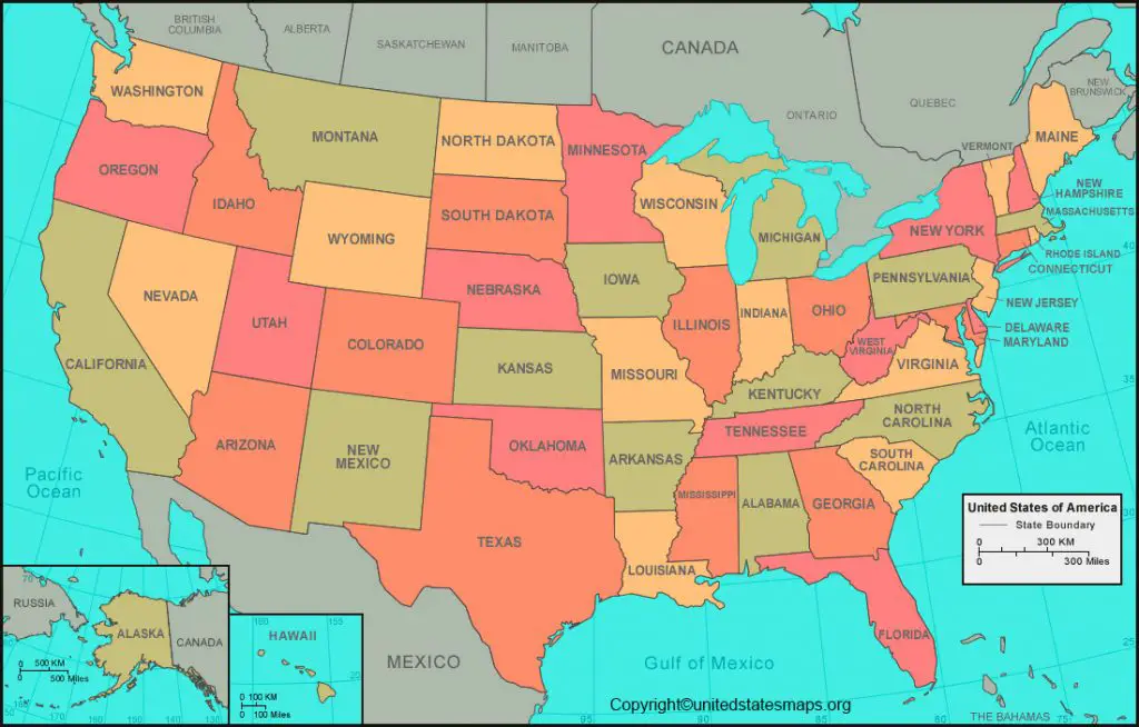
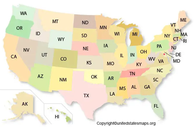
The US State Map comprises 50 states among which the highest population comes from CALIFORNIA and the lowest comes from WYOMING.
Check our other US maps:
A Map is a symbolic depiction emphasizing the relationship between elements of some space such as objects, regions, or themes.
The Map reading and Map drawing are two important skills to learn in geography. Maps help us to know distances so how far are we from one another?
US State Map
The Printable US State Map is an indispensable tool for geographers to use. The UNITED STATES State Map is located on the North American continent, bordered by The Pacific Ocean, The Atlantic Ocean, Canada to the north, and Mexico to the south.
The Map of the US has been divided into 7 geographic regions :
1. New England region
2.Mid Atlantic region
3. Southern region
4. Mid-west region
5. South-west region
6. Rocky mountains
7. Pacific coastal region
The United States of America Map is a federal republic. It consists of 50 states, one federal district, five larger territories, and several island territories. The 48 contiguous continental United States and Alaska are located in North America, while Hawaii and smaller areas are in the Pacific and Caribbean. The U.S. has a population of 330.2 million people and the widely spoken languages are English and Spanish.
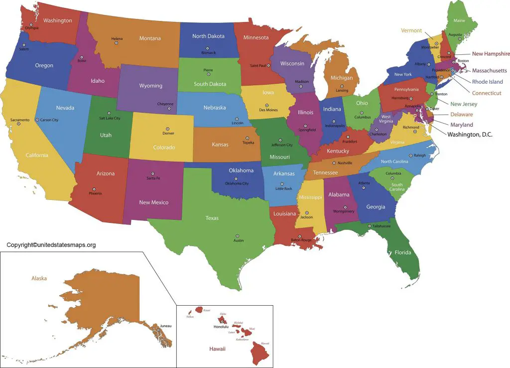
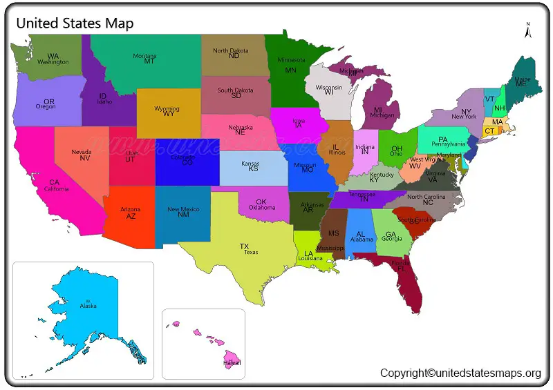
Map of the USA with State Names
With the help of Map Of US (US State Map), the top ten biggest states area-wise are :
1. Alaska (665384 sq. miles)
2. Texas (268596 sq. miles)
3. California(163696 sq. miles)
4. Montana(147040 sq. miles)
5. New Mexico(121590 sq. miles)
6. Arizona(113990 sq. miles)
7. Nevada(110572 sq. miles)
8. Colorado(104094 sq. miles)
9. Oregon(98379 sq. miles)
10. Wyoming(97813 sq. miles)
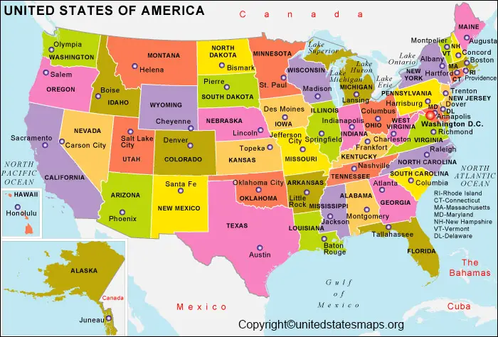
THE US LATITUDE LONGITUDE MAP:
US latitude and longitude are 38 degrees 00’N and 97 degrees 00’W
The Map of the USA with state names comprises 50 states among which the highest population comes from CALIFORNIA and the lowest comes from WYOMING.
Map of the USA with State Capitals
The U.S. is the world’s most powerful country and one of the largest which has a history of political revolution, social progress, and genocide.
The 50 U.S. states with their capitals :
-Alabama – Montgomery
-Alaska – Juneau
-Arizona -Phoenix
-Arkansas – Little Rock
-California – Sacramento
-Colorado – Denver
-Connecticut- Hartford
-Delaware – Dover
-Florida – Tallahassee
-Georgia- Atlanta
-Hawaii- Honolulu
-Idaho- Boise
-Illinois -Springfield
-Indiana- Indianapolis
-Iowa- Des Moines
-Kansas – Topeka
-Kentucky – Frankfort
-Louisiana – Baton rouge
-Maine – Augusta
-Maryland -Annapolis
-Massachusetts -Boston
-Michigan -Lansing
-Minnesota- St. Paul
-Mississippi- Jackson
-Missouri – Jefferson City
-Montana – Helena
-Nebraska – Lincoln
-Nevada – Carson City
-New Hampshire – Concord
-New Jersey – Trenton
-New Mexico – Santa Fe
-New York -Albany
-North Carolina – Raleigh
-North Dakota – Bismarck
-Ohio- Columbus
-Oklahoma- Oklahoma City
-Oregon-Salem
-Pennsylvania -Harrisburg
-Rhode Island- Providence
-South Carolina- Colombia
-South Dakota – Pierre
-Tennessee -Nashville
-Texas – Austin
-Utah – Salt lake city
-Vermont – Montpelier
-Virginia – Richmond
-Washington – Olympia
-West Virginia – Charleston
-Wisconsin – Midson
-Wyoming – Cheyenne
THE US STATE MAP CONTINENTS
1. The original Americans
2. Europeans come to America
3. The conquest of North America
4. Slavery and the Civil war
5. Becoming the United States
6. American Diversity
7. The Civil Rights Struggle
8. America as a global power
9. America today
THE ORIGINAL AMERICANS
1. ECO REGIONS OF NORTH AMERICA – The ecological diversity of the North American continent has played a central role in determining how it was settled and developed over millennia.
2. FIRST HUMAN MIGRATIONS TO AMERICA -The first migrant crossed from Asia into the new world. Many arrived by walking up to the northeast extreme of Asia.
3. ECONOMIC ACTIVITY IN PRE COLUMBUS AMERICA – An ancient American Marco polo who traveled across the continent recording observations about life across societies.
4. THE NATIVE PEOPLE AND LANGUAGES OF NORTH AMERICA – North America before Columbus didn’t have nation-states of the sort but it did have nations where people shared common cultural traits and languages.
5. WHAT THE US MIGHT LOOK LIKE IF EUROPEANS HADN’T COME-Its impossible to say what north America would look like if Columbus hadn’t arrived.
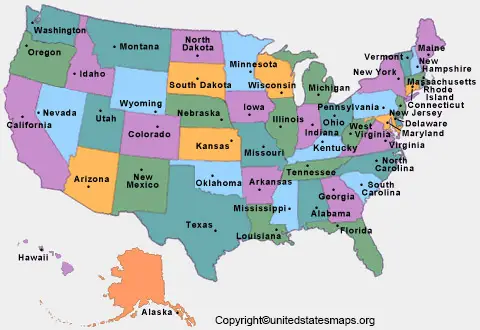
Map Of United States of America
EUROPEANS COME TO AMERICA
1. European exploration of North America
2. Where place names come from in America
3. How economics and trade shape the new world
4. Immigration from England
5. The first European colonies, as of 1660
THE CONQUEST OF NORTH AMERICA
1. North America’s political division since 1750
2. The major revolutionary war battles
3. The French and Indian war
4. Theft of native American’s land
SLAVERY AND THE CIVIL WAR
1. The trans-Atlantic slave trade
2. The evolution of slavery in the united states
3. Concentration of slaves in THE U.S.
4. The crucial 1860 election
5. When states seceded in the months before the civil war
6. The civil war
7. The anaconda plan
BECOMING THE USA States Map
1. U.S territorial evolution
2. The trail of tears
3. The Mexican American war
4. Settling the west
5. The mean population center over time
6. The dust bowl
7. The great migration
8. How migration spread the blues
9. Interstate highway system
The above information provides various state facts. This map of the state of USA data emphasizes accurate data in communicating spatial data that is well matched with geographic characteristics. Population, race, and ethnic groups, total area, border states, geographical regions, some history, a major river, lakes, cities, national parks, and airports.