North Carolina Beaches Map: North Carolina is renowned for its stunning coastline, boasting a plethora of breathtaking beaches that attract visitors from all over the world. Exploring the North Carolina beaches is made easier with the help of a comprehensive North Carolina Beaches Map. This map provides an excellent guide to navigating the coastal areas, highlighting the various beaches and their unique characteristics.
North Carolina Beaches Map
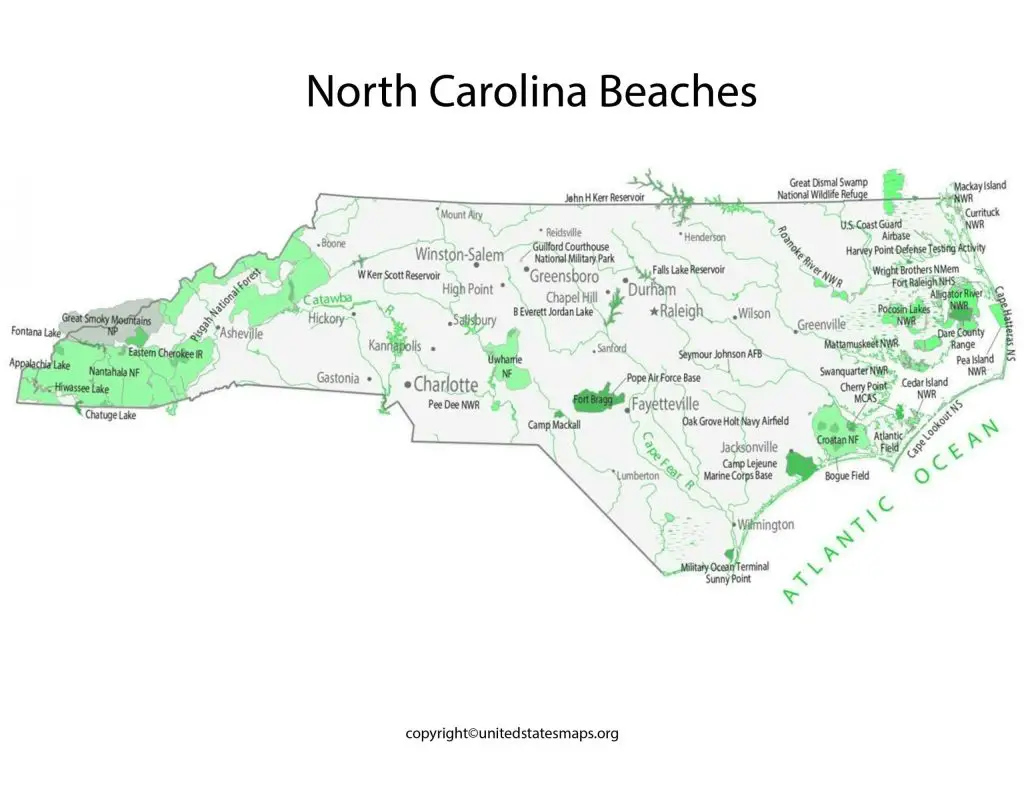
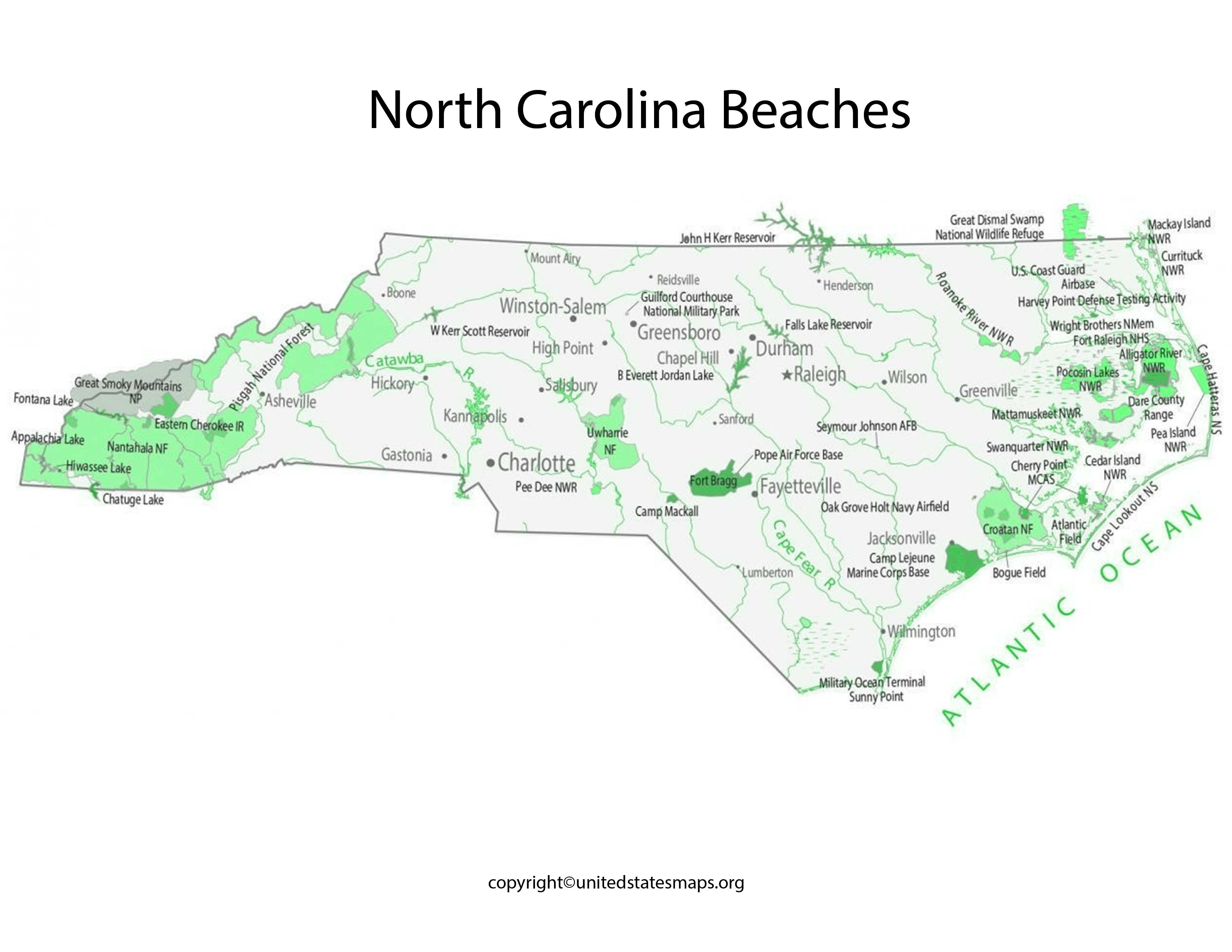
The North Carolina Beach Map presents a comprehensive overview of the coastal regions, allowing visitors to explore the diverse range of beaches from north to south. Starting in the northernmost part of the state, the map highlights the legendary Outer Banks, a series of barrier islands known for their pristine beaches, charming beach towns, and historical significance. From the iconic Cape Hatteras to the wild horses of Corolla, the map points out the must-see landmarks and attractions along this captivating stretch of coastline.
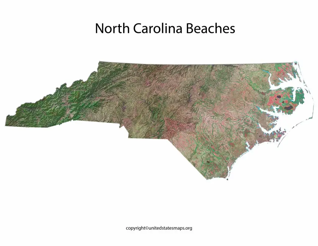
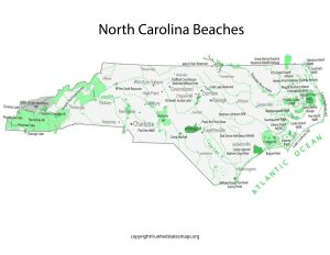
The North Carolina Beaches Map showcases the entire coastline, stretching from the northernmost beaches near the Virginia border to the southernmost beaches bordering South Carolina. With over 300 miles of coastline, North Carolina offers a diverse range of beach experiences, each with its own charm and appeal.
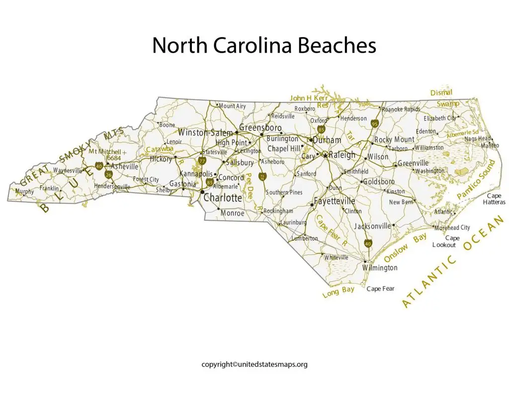
The map provides detailed information about the major beach towns and cities along the coast, such as Kitty Hawk, Nags Head, Kill Devil Hills, Emerald Isle, Wilmington, and Wrightsville Beach. It also marks the lesser-known hidden gems that are worth exploring for a quieter and more secluded beach experience. Check out other Beach Maps:- Florida Beaches Map, Myrtle Beach Map.
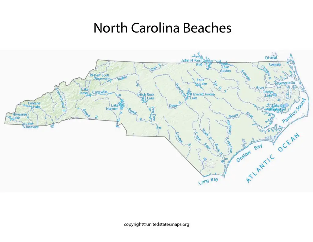
One of the prominent features of the North Carolina Beaches Map is the identification of the various barrier islands that protect the mainland from the Atlantic Ocean. These islands, including the Outer Banks, Topsail Island, and Bald Head Island, not only provide stunning natural beauty but also offer opportunities for water sports, fishing, and birdwatching.
Map of North Carolina Beaches
The Beaches of North Carolina Map unveils the breathtaking coastal beauty and countless opportunities for seaside enjoyment that await visitors along the eastern shores of this charming state. With its extensive coastline, North Carolina is home to a rich tapestry of beaches, each offering its own unique charm, recreational activities, and natural wonders.
The Map of North Carolina Beaches serves as a visual gateway to the picturesque coastline of this charming southeastern state. Stretching from the Outer Banks in the north to the Brunswick Islands in the south, North Carolina offers a wealth of sandy shores, crystal-clear waters, and stunning natural landscapes.
The Map of North Carolina Beaches provides an overview of the state’s coastal regions, showcasing the diverse array of beaches along the Atlantic Ocean. Starting from the northernmost point, visitors can explore the legendary Outer Banks, a chain of narrow barrier islands known for their rich history, captivating maritime forests, and iconic lighthouses.
As you follow the coastline southward on the map, you’ll encounter popular destinations such as Kill Devil Hills, Nags Head, and Kitty Hawk. These areas offer not only pristine beaches but also opportunities for water sports like surfing, kiteboarding, and kayaking. The map highlights public beach access points and parking areas, making it easier for beachgoers to plan their visits.
Beaches in North Carolina Map
As you explore the North Carolina Map of Beaches, you’ll encounter the legendary Outer Banks, a collection of barrier islands renowned for their historical significance and natural beauty. From Cape Hatteras to Corolla, the map identifies key landmarks such as lighthouses, wildlife refuges, and ferry terminals, enabling visitors to fully immerse themselves in the unique charm of the region.
The Beaches in North Carolina Map is a valuable resource for beach enthusiasts looking to explore the coastal wonders of this beautiful state. Nestled along the southeastern United States, North Carolina offers a wealth of stunning beaches that cater to every type of visitor, from avid sunbathers to outdoor adventurers.
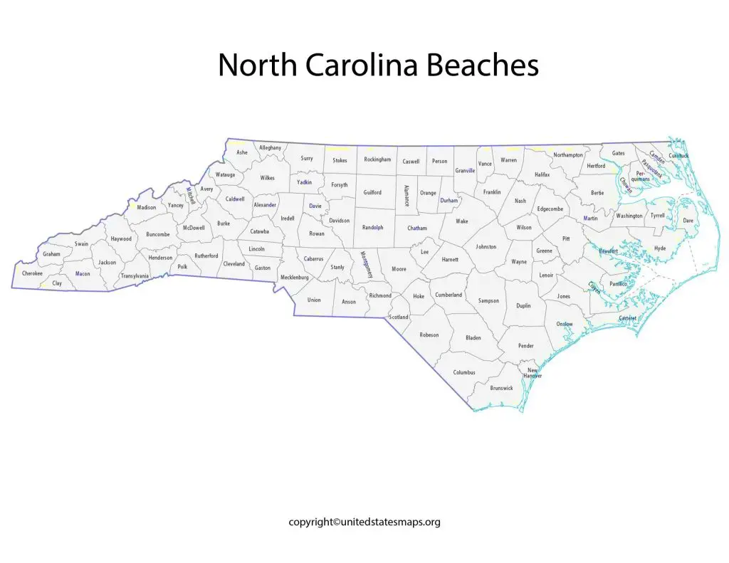
This comprehensive map showcases the various beaches located throughout North Carolina, providing an easy-to-navigate guide to plan your beach getaway. From the northernmost beaches bordering Virginia to the southernmost stretches near South Carolina, the map covers the entire coastline, highlighting each unique beach destination along the way.
Starting in the north, the map introduces the legendary Outer Banks, a series of barrier islands renowned for their pristine beaches, historic landmarks, and unparalleled natural beauty. Visitors can explore popular spots like Cape Hatteras, Corolla, and Duck, each offering its own distinctive charm and attractions. The map also marks the ferry terminals for those interested in venturing to more remote and less developed beaches.
Continuing along the coast, the map highlights the Crystal Coast, a picturesque region encompassing breathtaking beaches like Emerald Isle, Atlantic Beach, and Beaufort. Each of these destinations offers a unique blend of natural beauty, recreational opportunities, and cultural attractions. The map also indicates nearby state parks and nature reserves, inviting visitors to explore the diverse ecosystems and wildlife habitats found in the area.