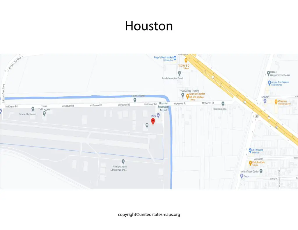
Houston Airport Map: The Houston Airport, officially known as George Bush Intercontinental Airport (IAH), is a major transportation hub serving the Houston metropolitan area in Texas, United States. Situated approximately 23 miles north of downtown Houston, this sprawling airport covers a vast area of land and offers a multitude of facilities to accommodate the millions of travelers passing through its terminals each year.
Houston Airport Map
The map of Houston Airport encompasses the entire George Bush Intercontinental Airport (IAH) and provides an extensive view of its layout. This map is a valuable resource for travelers, whether they are first-time visitors or frequent flyers, as it helps them familiarize themselves with the airport’s infrastructure and make their journey smoother.
The Houston Airport Food Map showcases the diverse range of dining options available at George Bush Intercontinental Airport (IAH). As one of the busiest airports in the United States, IAH offers an array of culinary choices to cater to various tastes and preferences.
The Houston Airport map provides a comprehensive overview of the airport’s layout and infrastructure. It showcases the various terminals, concourses, gates, parking areas, and other essential amenities. Navigating such a large airport can be daunting for first-time visitors or those unfamiliar with the layout, but with the help of this detailed map, travelers can easily find their way around and make the most of their time at the airport. Check out other Houston maps:- Houston Zip Code Map, Houston Rainfall Map.
The map displays all the terminal buildings, concourses, and gates within the airport, enabling passengers to locate their departure or arrival points with ease. It also highlights other essential areas such as baggage claim, ticketing counters, security checkpoints, and parking facilities. Additionally, the map may include important information on amenities like dining options, shops, lounges, and transportation services available within the airport premises.
George Bush Intercontinental Airport Map
George Bush Intercontinental Airport (IAH) is one of the primary airports serving Houston, Texas. The airport is named after George H. W. Bush, the 41st President of the United States. Covering an expansive area, the George Bush Intercontinental Airport map offers a comprehensive overview of the airport’s facilities and services.
The map of George Bush Intercontinental Airport (IAH) offers an in-depth overview of one of the busiest airports in the United States. Spread across a vast area, this map provides a comprehensive guide to the airport’s layout, facilities, and services, allowing travelers to navigate the airport effortlessly.
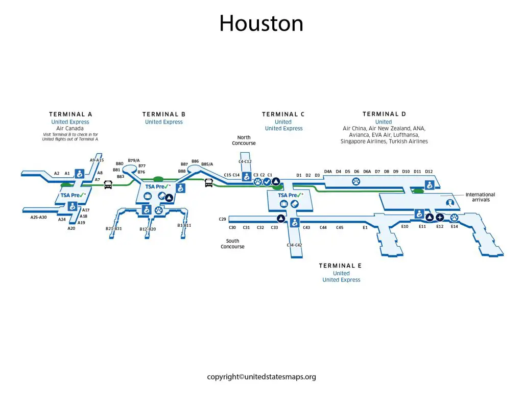
The map features all the terminals, concourses, and gates within George Bush Intercontinental Airport. It clearly labels each section, making it easier for passengers to find their way around and locate their specific gates or amenities. The map may also include additional information, such as the locations of baggage claim areas, ticketing counters, security checkpoints, and ground transportation options, ensuring a smooth travel experience for passengers.
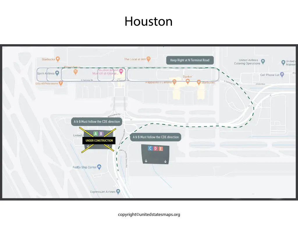
The map highlights the main terminal buildings, including Terminal A, Terminal B, Terminal C, and Terminal D. It also displays the various concourses and gates within each terminal, making it easier for passengers to locate their departure or arrival gates. Additionally, the map includes important areas such as baggage claim, ticketing counters, security checkpoints, parking lots, and ground transportation options.
Houston Airport Terminal Map
Terminal A is one of the major terminals at George Bush Intercontinental Airport (IAH) in Houston, Texas. The Houston Airport Terminal A map provides a detailed layout of this particular terminal, helping passengers navigate its facilities and services effectively.
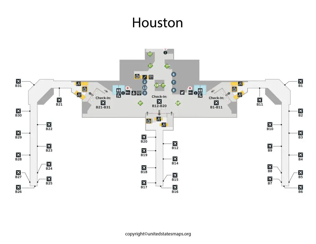
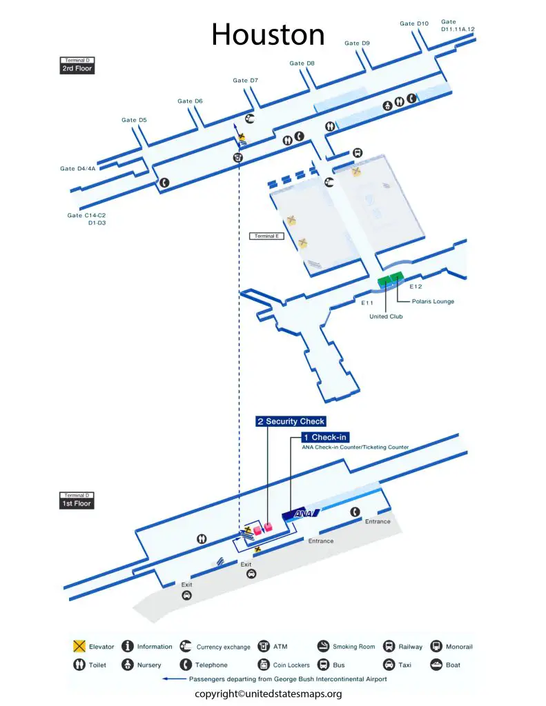
The Houston Airport Gate Map highlights the gates within each terminal, making it convenient for passengers to find their assigned gates or connect to their next flights. It also provides additional information on nearby amenities such as restaurants, shops, restrooms, and lounges, allowing passengers to plan their time at the airport efficiently while ensuring they reach their gates on time.
And then the map highlights the different levels of Terminal A, including the arrival and departure areas. It showcases the gates, ticketing counters, security checkpoints, and baggage claim zones within the terminal. But by referring to this map, travelers can easily locate their gates, access various amenities such as restaurants and shops, and ensure a hassle-free journey through Terminal A.
The Houston Airport Terminal map provides a detailed layout of the terminals at George Bush Intercontinental Airport (IAH). But with several terminals catering to domestic and international flights, the map is an invaluable resource for travelers seeking to navigate the airport efficiently.
Each terminal is color-coded and labeled for easy identification. And then the Passengers can quickly locate the terminal they need based on their airline or flight information. The map also highlights the amenities available within each terminal, such as restaurants, shops, lounges, and information desks. This helps passengers plan their time at the airport and make the most of the services provided.
Houston Hobby Airport Map
The airports in Houston map presents a comprehensive view of the major airports serving the city of Houston, Texas. And then the map highlights the locations and names of these airports, providing travelers with a clear understanding of the airport infrastructure in the area.
The primary airports in Houston include George Bush Intercontinental Airport (IAH), William P. Hobby Airport (HOU), and Ellington Field Airport (EFD). And then the map shows the relative positions of these airports in relation to the city center and other significant landmarks. This information is particularly helpful for travelers looking to choose the most convenient airport for their travel needs or those planning transportation routes in and around Houston.
Houston Hobby Airport, officially known as William P. Hobby Airport (HOU), is another major airport serving the Houston area. The Houston Hobby Airport map showcases the airport’s layout, facilities, and services, providing travelers with a comprehensive guide to navigate the airport seamlessly.
And then the map features the terminal building and its different concourses, along with the corresponding gate numbers. It also indicates the locations of baggage claim areas, ticketing counters, security checkpoints, and ground transportation options, enabling passengers to find their way easily and efficiently. Additionally, the map may highlight amenities such as dining options, shops, and other services available within the terminal.