Charlotte Zip Code Map: Charlotte, North Carolina is a bustling city with many different zip codes. This map will help you find your way around the city and locate different neighborhoods, landmarks, and attractions.
Check our other Zip Code maps:
- Houston Zip Code Map
- Las Vegas Zip Code Map
- Chicago Zip Codes Map
- California Zip Code Map
- Georgia Zip Code Map
- Texas Zip Code Map
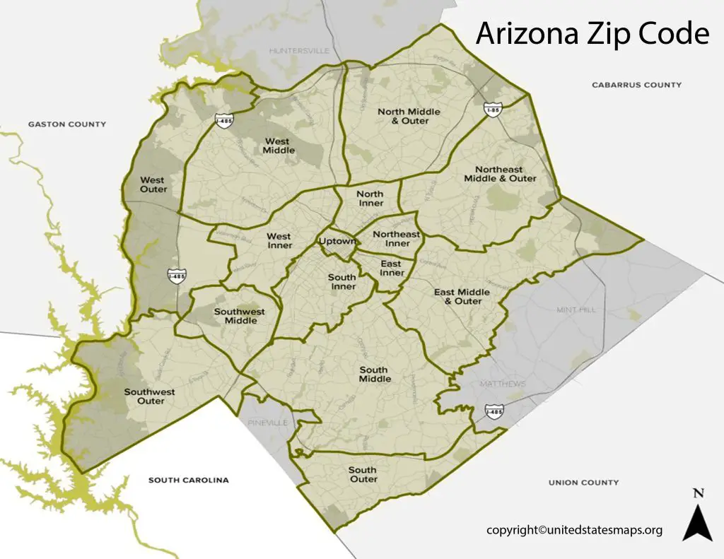
Charlotte Zip Code Map
Charlotte, the largest city in North Carolina, has several zip codes that divide the city into different regions. A Charlotte zip code map is a useful tool for understanding the geographic layout of the city and the neighborhoods within it. With the help of a zip code map, you can easily locate your place of work or residence, plan your commute, or find nearby amenities and services.
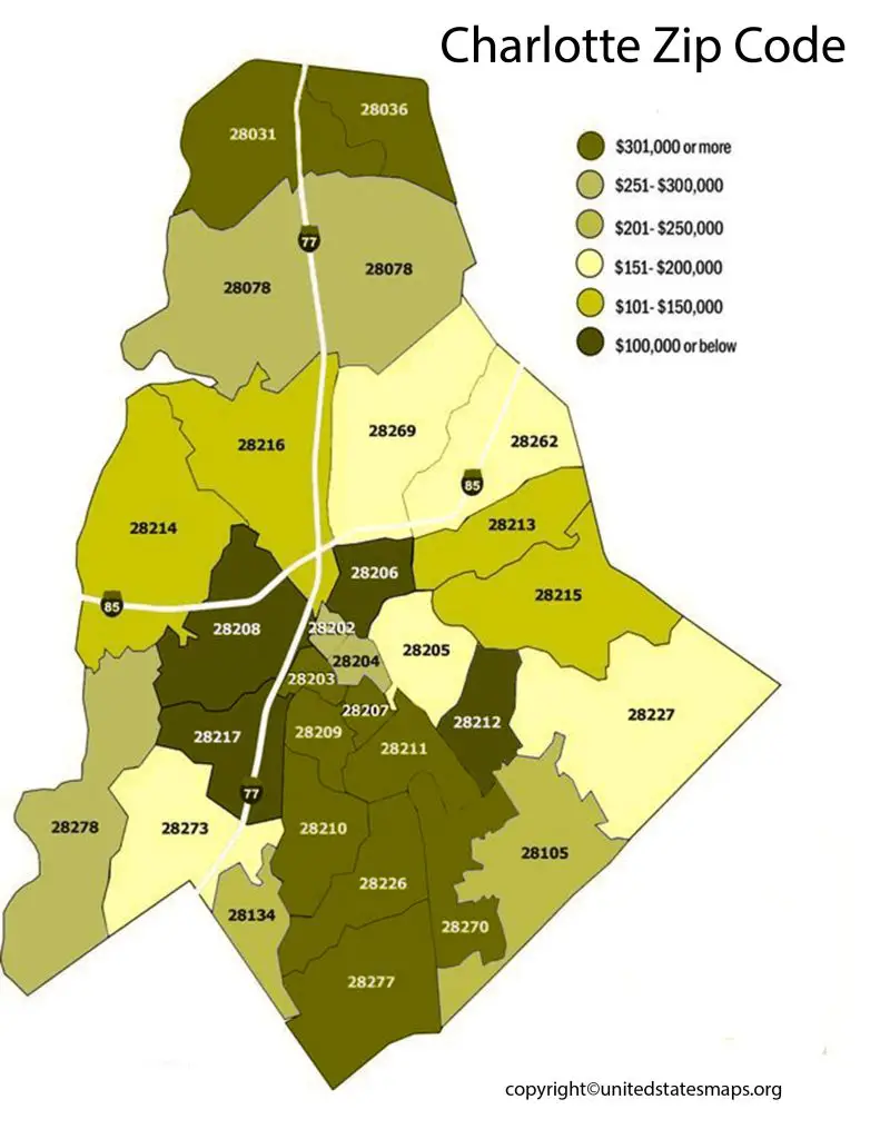
The zip code map of Charlotte includes areas such as Uptown Charlotte, South End, Dilworth, Myers Park, Ballantyne, Steele Creek, University City, and many more. Each zip code represents a specific area of the city, with its unique characteristics and attractions. For instance, Uptown Charlotte is the commercial and cultural hub of the city, while South End is known for its hip restaurants and breweries.
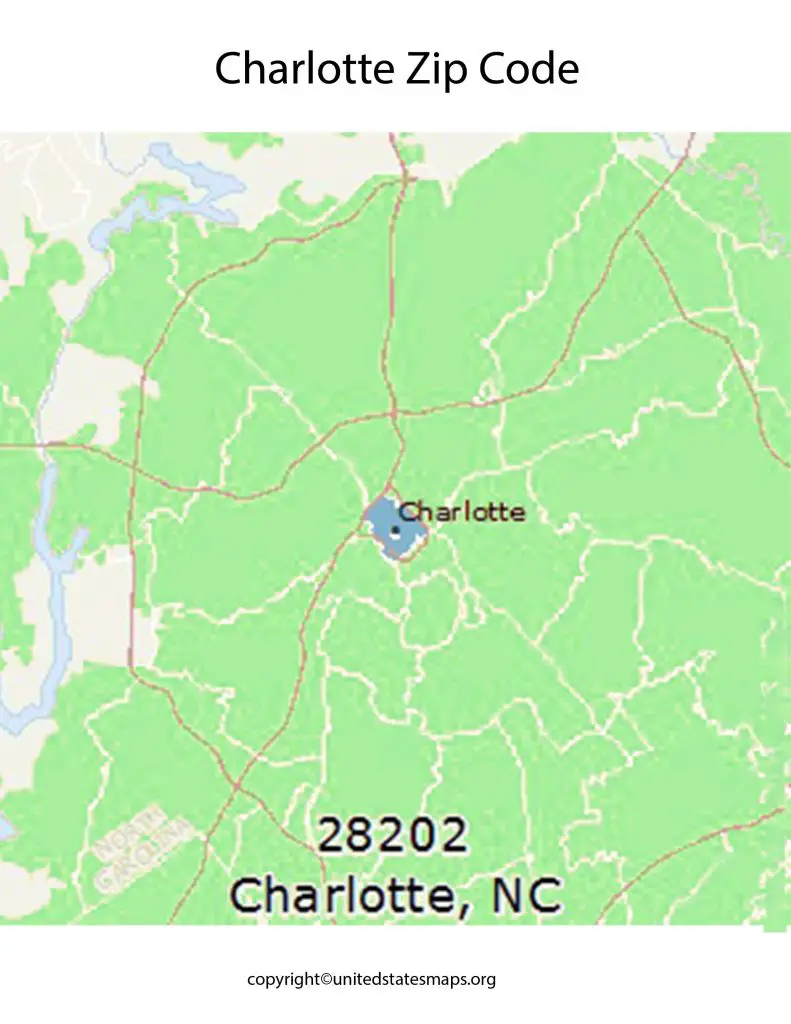
A Charlotte zip code map can also help you identify areas with higher crime rates or lower-income neighborhoods, which may affect your housing choices. Moreover, understanding the zip codes of Charlotte can help you explore the city’s history and culture. For example, the 28202 zip code covers the First Ward, which is one of the oldest and most diverse neighborhoods in Charlotte.
The zip code map of Charlotte NC, is a detailed and comprehensive tool that helps residents, visitors, and businesses understand the city’s layout and demographics. Charlotte has over 40 zip codes that divide the city into different neighborhoods and regions, each with its unique characteristics and attractions.
The zip code map of Charlotte, NC, is useful for a variety of purposes. For instance, it can help residents plan their commute or locate nearby amenities and services, such as grocery stores, hospitals, or schools. It can also help visitors explore the city’s different neighborhoods and attractions, such as museums, parks, or restaurants.
Map of Charlotte with Zip Codes
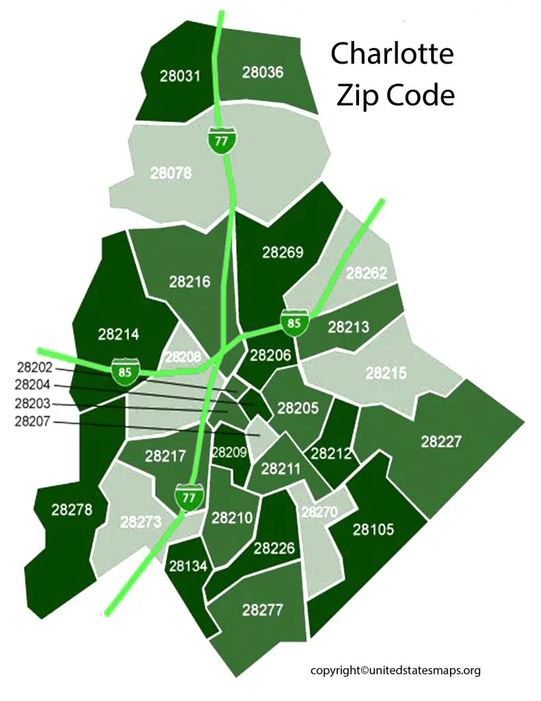
A Charlotte map with zip codes is a detailed representation of the city’s layout, including major streets, highways, neighborhoods, and zip codes. It is a useful tool for residents, visitors, and businesses alike, providing a clear visual understanding of the city’s geography and layout.
A map of Charlotte with zip codes can be used for a variety of purposes. For instance, it can help you plan your commute to work or school by identifying the best route to take based on your zip code. It can also help you locate nearby amenities and services, such as grocery stores, parks, and hospitals. Additionally, a map of Charlotte with zip codes can help you explore the city’s different neighborhoods and their unique characteristics.
One benefit of a map of Charlotte with zip codes is that it can help you understand the city’s demographics. Certain zip codes may have a higher concentration of certain ethnic groups or income levels, which can affect the types of businesses and services available in those areas.
In conclusion, a map of Charlotte with zip codes is an indispensable tool for anyone who wants to navigate the city effectively. It provides a clear visual representation of the city’s layout and helps you locate specific areas and amenities with ease.
Zip Code for Charlotte Nc Map
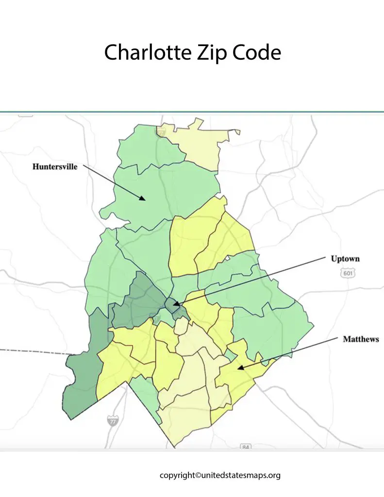
The Charlotte area zip code map is a comprehensive tool that provides a visual representation of the different zip codes and neighborhoods in the Charlotte metropolitan area. The Charlotte area includes not only the city of Charlotte but also surrounding suburbs and towns that make up the broader metropolitan region.
The zip code for Charlotte NC, map can help you find your way around the city, plan your commute, or locate nearby amenities and services. For instance, if you are looking for a particular restaurant or store, you can use the map to find the zip code for that area and navigate your way there. Similarly, if you are planning to move to Charlotte, the zip code for Charlotte, NC, map can help you identify neighborhoods that fit your lifestyle and budget.
Moreover, understanding the zip code for Charlotte, NC, map can also help you understand the city’s demographics and history. Certain zip codes may have a higher concentration of certain ethnic groups or income levels, which can affect the types of businesses and services available in those areas. Additionally, knowing the history of certain neighborhoods can help you appreciate the cultural and architectural significance of the area.
The zip code for Charlotte, NC, map is also useful for businesses and organizations that need to target specific areas of the city for marketing or outreach purposes. By understanding the zip codes of different neighborhoods, they can tailor their messaging and promotions to the needs and interests of those communities.