The Arizona Rainfall Map is an informative tool that helps users understand the weather patterns in Arizona. Our detailed map provides comprehensive information on the average rainfall levels across the state, enabling users to plan their activities accordingly. Whether you’re a hiker, a farmer, or just want to stay informed about the weather, our Arizona Annual Rainfall Map is an essential resource.
Check out our other Rainfall related Maps:
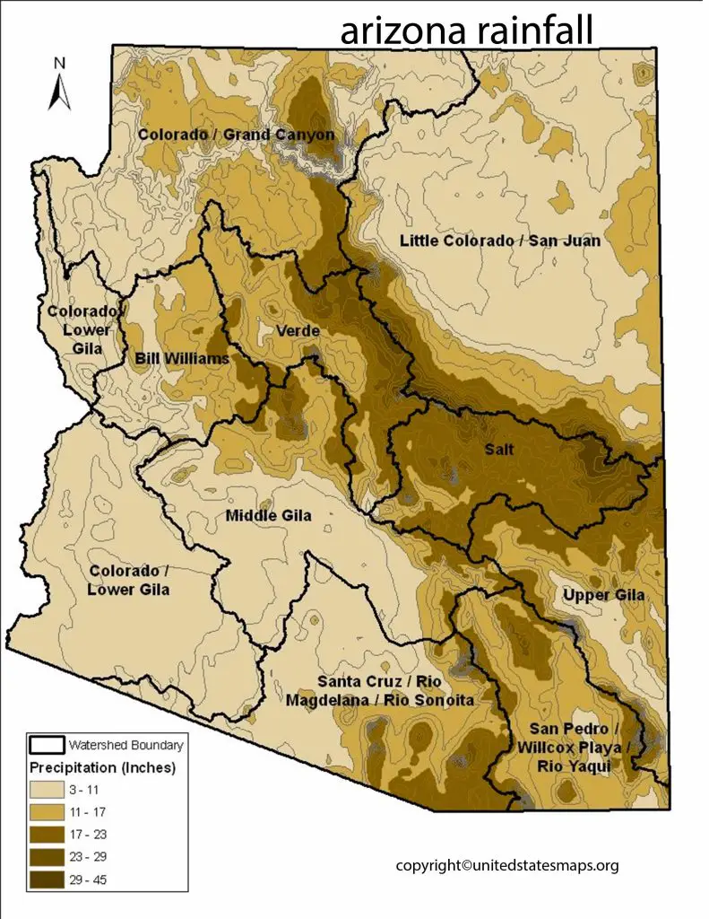
Arizona is a southwestern state of the United States, known for its beautiful deserts and breathtaking landscapes. Despite its arid climate, Arizona receives rainfall throughout the year, but its distribution is uneven. The Arizona Rainfall Map provides detailed information on the precipitation patterns of the state.
Arizona is known for its dry, desert-like climate, but that doesn’t mean it never rains. In fact, Arizona receives an average of 12 inches of rainfall per year, with some areas receiving more than others. A rainfall map of Arizona can help residents and visitors alike understand where the rain falls and how much they can expect in different parts of the state.
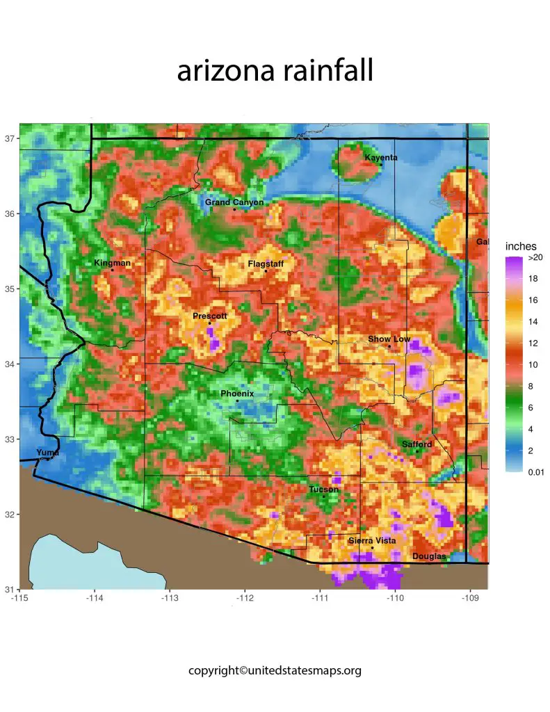
The map shows that the northern part of Arizona receives more rainfall than the southern region. This is due to its higher elevation and proximity to mountains which promote precipitation. The mountain ranges act like barriers that force moist air upward causing it to cool and condense into clouds releasing precipitation. Southern Arizona on the other hand has a lower elevation with flat terrain which makes it drier.
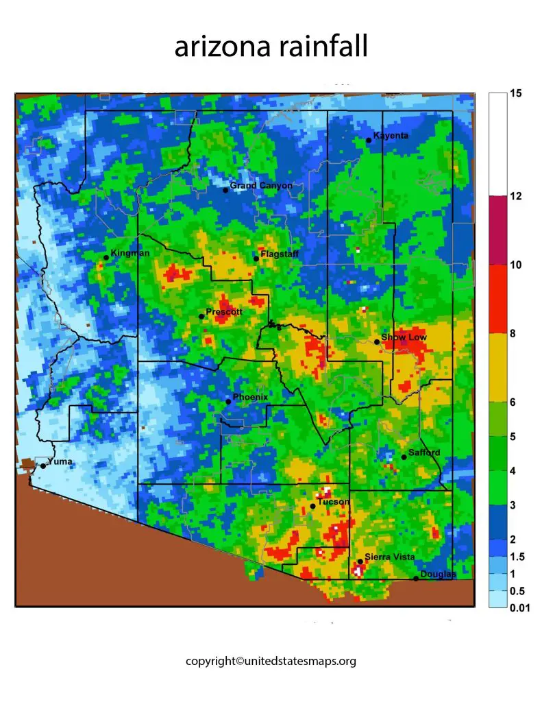
While most people might assume that monsoon season is when most of the rain falls in Arizona. This isn’t necessarily true for every area of the state.
The rainfall map of Arizona displays the average annual rainfall received in each region of the state. The map shows that the northern part of Arizona receives more rainfall than the southern part. The mountainous regions of northern Arizona, including the Grand Canyon, receive the highest amount of rainfall. The map also shows that the eastern part of the state receives more rainfall than the western part.
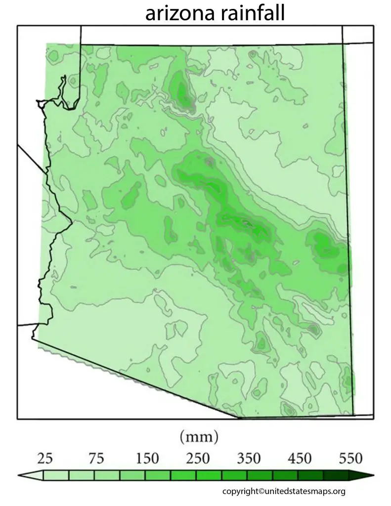
Arizona Annual Rainfall Map
The Rainfall Map Arizona, also known as the Arizona Rainfall Map or Arizona Annual Rainfall Map, displays the precipitation patterns of the state. The map shows that Arizona has a dry climate with uneven distribution of rainfall.
The Arizona Annual Rainfall Map displays the total amount of rainfall received in each region of the state over the course of a year. The map shows that the average annual rainfall in Arizona is approximately 13 inches, with significant variations in different regions. The northern part of Arizona receives the highest amount of rainfall, with the mountainous regions receiving the most. The southern part of the state receives less rainfall, with the desert regions receiving the least. The eastern part of Arizona receives more rainfall than the western part.
In the northern part of Arizona, the annual rainfall ranges from 20 to 27 inches, while in the southern part, it ranges from 7 to 13 inches. The eastern part of Arizona receives more rainfall than the western part, with annual rainfall ranging from 12 to 16 inches in the east and 7 to 11 inches in the west.
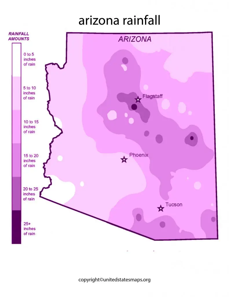
Arizona Average Rainfall Map
The rainfall maps of Arizona provide a comprehensive understanding of the state’s precipitation patterns. These maps are essential for farmers, meteorologists, and water resource managers to plan and manage water resources in the state. The maps also help tourists and nature enthusiasts to plan their visits to different regions of Arizona based on the rainfall patterns.
The Arizona Average Rainfall Map displays the average amount of rainfall received in each region of the state. The map shows that the highest average rainfall occurs in the mountainous regions of northern Arizona, including the Grand Canyon.
The average annual rainfall in these regions ranges from 20 to 27 inches. The eastern part of Arizona also receives higher average rainfall, ranging from 12 to 16 inches. The western part of the state, including Phoenix and the surrounding area, receives the lowest average rainfall, ranging from 7 to 11 inches.