Explore the vastness of Texas with our detailed Texas County Map. From the bustling metropolis of Houston to the rugged landscape of Big Bend National Park, Texas is a state full of diversity and adventure. With our interactive map, you can discover the cities and towns of each county and plan your next Lone Star State adventure.
Texas County Map
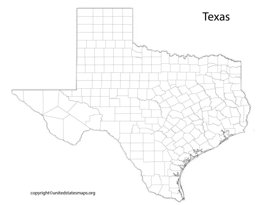
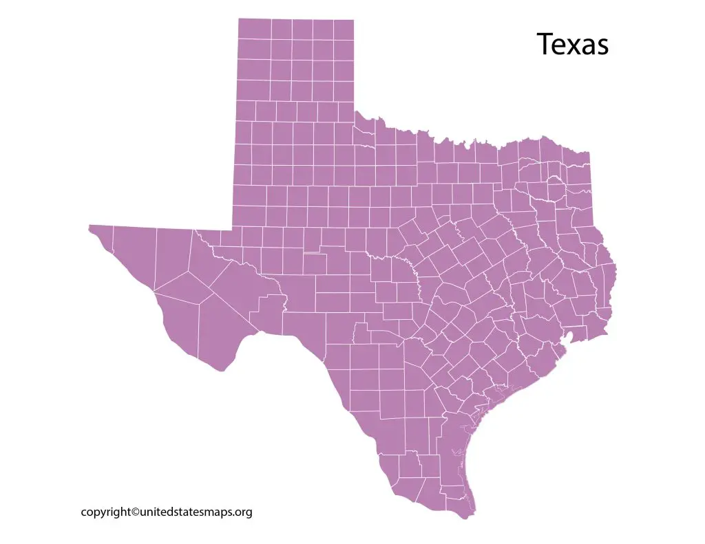
The state of Texas is the second-largest state in the United States and is made up of 254 counties. A Texas county map a visual representation of the state’s counties and their boundaries. This map is helpful for a variety of purposes, including navigation, election analysis, demographic research, and more. Check other Texas maps:- Texas Zip Code Map, Texas Rainfall Map, Texas Political Map, Texas Time Zone Map.
From Houston to El Paso and from Dallas to San Antonio, a Texas map by county can help you explore every corner of this great state. Whether you’re planning a road trip through the Hill Country or looking for directions to a small town on the outskirts of Austin, this type of map will ensure you never get lost along the way.
In addition to helping with navigation, a Texas map by county also provides insights into each region’s history and culture. From cattle ranches in West Texas to oil fields in the Permian Basin, each county has its unique story that adds depth and character to this diverse state.
A map of Texas counties a detailed map that shows the location of all 254 counties in the state. This type of map useful for a variety of purposes, including planning road trips, conducting demographic research, analyzing election results, and more.
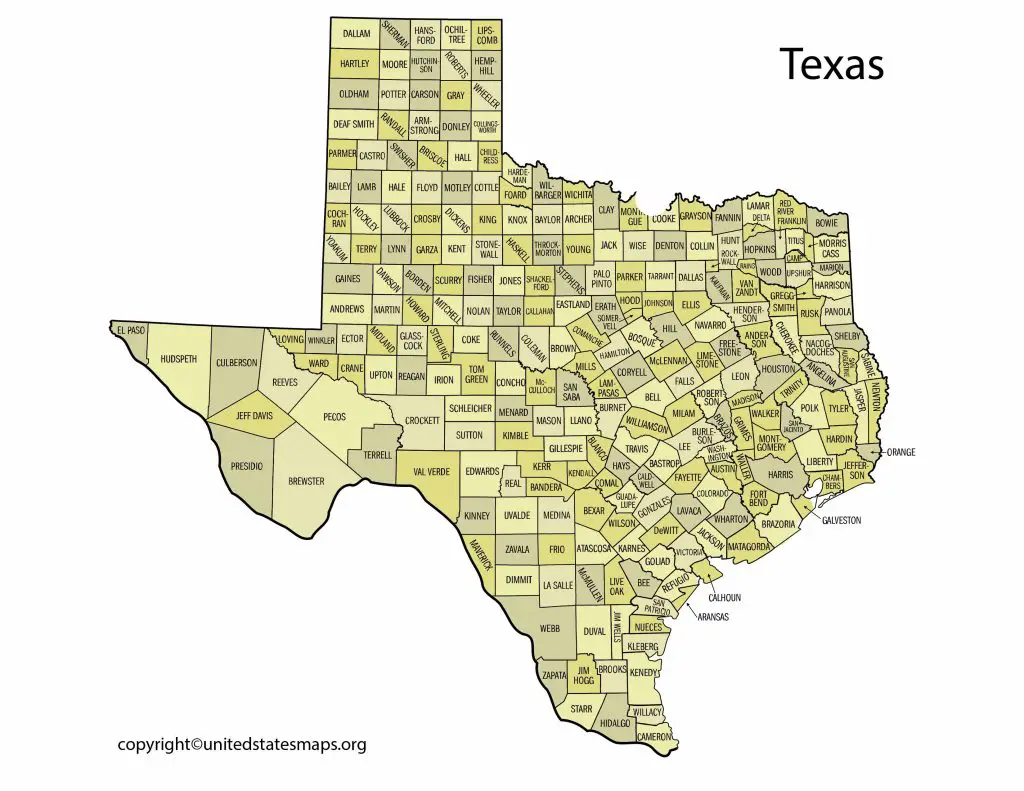
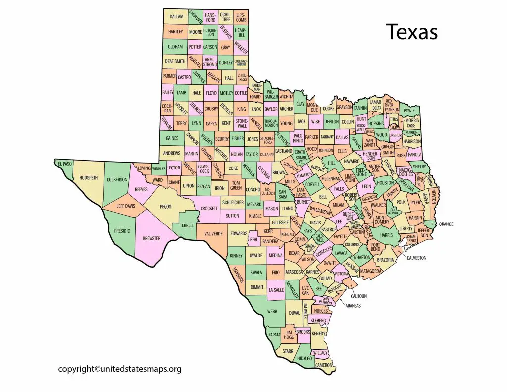
The Texas county map divided into four regions: North Texas, West Texas, Central Texas, and South Texas. Each region characterized by its unique geography, climate, and culture. North Texas known for its rolling hills and urban centers, while West Texas known for its rugged terrain and oil fields. Central Texas home to the state capital, Austin, and known for its vibrant music scene and historic landmarks. South Texas, on the other hand, known for its Gulf Coast beaches and border towns.
Texas Map with Counties
A county map of Texas a visual representation of the state’s 254 counties and their boundaries. This type of map useful for a variety of purposes, including navigation, election analysis, demographic research, and more.
The county map of Texas divided into four regions: North Texas, West Texas, Central Texas, and South Texas. Each region has its own unique characteristics, from the rolling hills of North Texas to the rugged terrain of West Texas. Central Texas home to the state capital, Austin, and known for its vibrant music scene and historic landmarks. South Texas known for its Gulf Coast beaches and border towns.
A map of counties in Texas a detailed map that shows the location of all 254 counties in the state. This type of map useful for a variety of purposes, including planning road trips, conducting demographic research, analyzing election results, and more.
The Texas map with counties divided into four regions: North Texas, West Texas, Central Texas, and South Texas. Each region has its own unique characteristics, from the urban centers of North Texas to the rugged terrain of West Texas. Central Texas home to the state capital, Austin, and known for its music scene and historic landmarks. South Texas known for its Gulf Coast beaches and border towns.
County Map of Texas
A Texas city county map a visual representation of the state’s counties and the cities located within each county. This type of map useful for a variety of purposes, including navigation, election analysis, demographic research, and more.
Texas the second largest state in the United States and home to over 29 million people. One of the most important resources for navigating this vast state a Texas map by county. This type of map provides an easy-to-use guide that outlines all 254 counties in Texas.
A county map of Texas a valuable resource for anyone who wants to explore this vast state. Whether you’re a student researching the geography of Texas, or an adventurer looking for hidden gems. A county map can provide you with key information about each region. The counties are color-coded on the map which makes it easy to identify different regions and their borders.
Texas has 254 counties, making it the second-largest state in terms of counties after Georgia. Each county has its own unique culture, history and attractions. A county map of Texas will help you discover these differences as you travel through the state. From rolling hills and prairies in North Texas, to deserts and canyons in West Texas. From coastal plains in South Texas to pine forests in East Texas – every region has something special to offer.