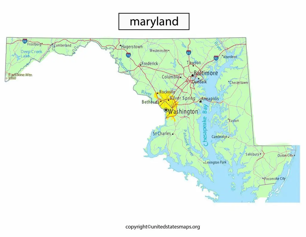
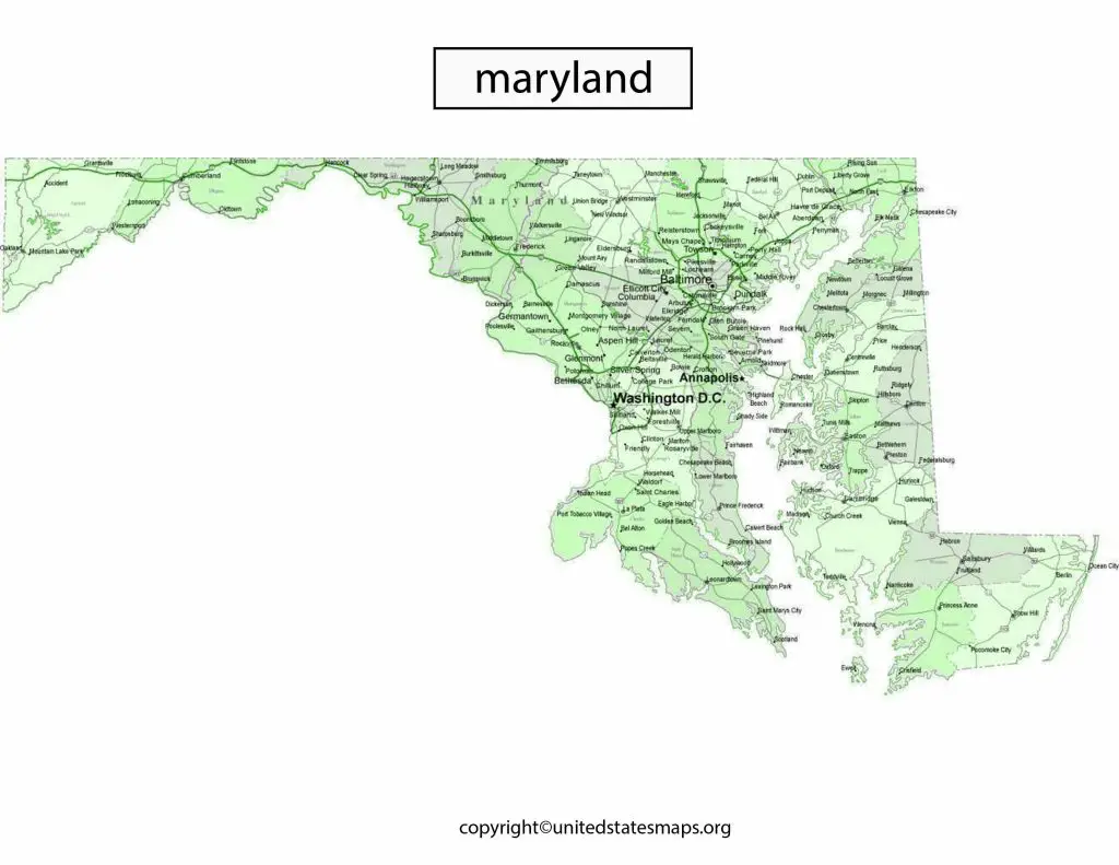
The Maryland Political Map is a visual representation of the state’s political geography, highlighting the boundaries of congressional districts, county lines, and major cities. This map provides valuable insights into Maryland’s political landscape, including voting patterns and demographic trends.
We have other related Political maps on our website:
Maryland Political Map
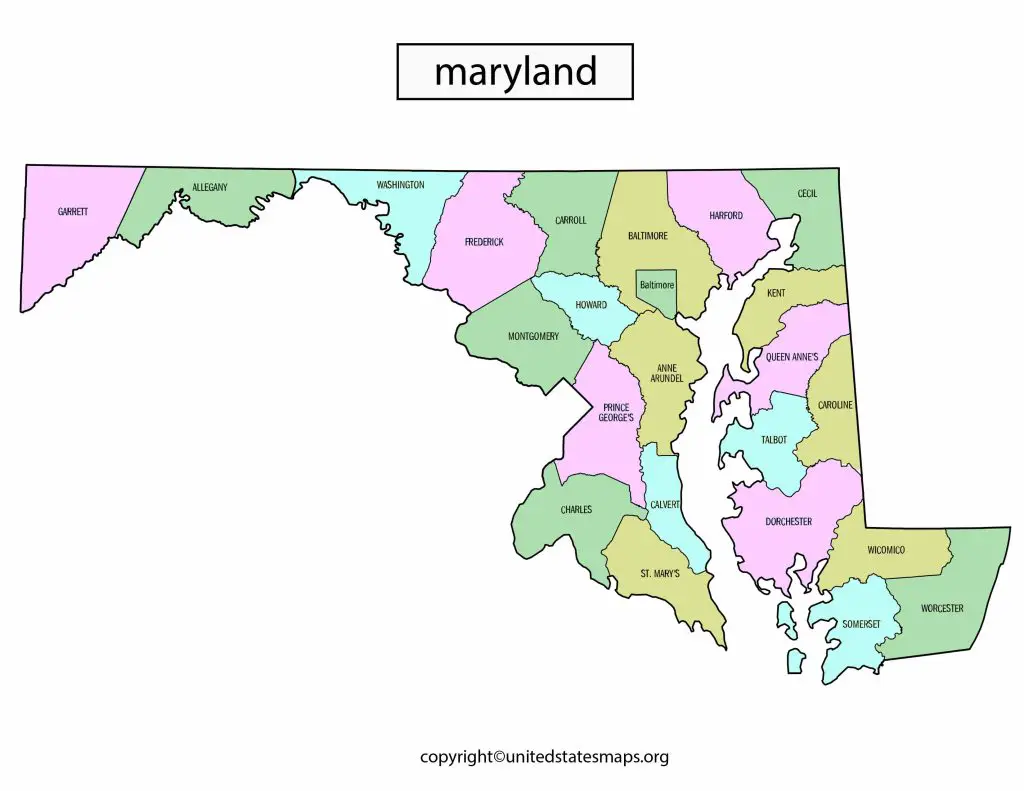
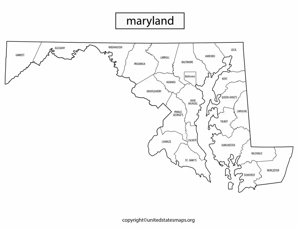
Maryland state’s political map divided into eight congressional districts, 47 state legislative districts, and 23 counties, each with their own unique political landscape. The capital city of Maryland Annapolis, located in Anne Arundel County, which also home to the U.S. Naval Academy.
The state of Maryland known for its rich history and diverse culture, which reflected in its political map. The state has a strong Democratic presence in its larger cities, such as Baltimore and the Washington D.C. suburbs, while its rural areas tend to lean more Republican. In recent years, Maryland has become more politically polarized, with contentious races for governor and other statewide offices.
Maryland known for its strong Democratic presence in its larger cities, such as Baltimore and the Washington D.C. suburbs. The state has voted Democratic in every presidential election since 1992, and its two U.S. Senators both Democrats. However, the state’s rural areas tend to lean more Republican, and the state has a history of electing Republican governors.
Maryland Political Party Map reflects the state’s complex political landscape, with a mix of urban and rural areas that often have different political views. The state also home to a large number of independent voters who play an important role in determining election outcomes.
Political Map of Maryland
Maryland state political map shows the state divided into eight congressional districts, 47 state legislative districts, and 23 counties, each with its own unique political landscape. The state’s two U.S. Senators represent the entire state, and the governor and other statewide elected officials also elected by voters statewide.
Maryland’s political landscape complex, with a mix of urban and rural areas that often have different political views. The state known for its strong Democratic presence in its larger cities, such as Baltimore and the Washington D.C. suburbs, while its rural areas tend to lean more Republican. However, the state also home to a large number of independent voters who play an important role in determining election outcomes.
Maryland’s political map shows the state divided into eight congressional districts, each represented by a member of the U.S. House of Representatives. The state’s two U.S. Senators represent the entire state, and the governor and other statewide elected officials also elected by voters statewide.
Maryland’s political landscape complex, with a mix of urban and rural areas that often have different political views. The state has a strong Democratic presence in its larger cities, such as Baltimore and the Washington D.C. suburbs, while its rural areas tend to lean more Republican. The state also home to a large number of independent voters who play an important role in determining election outcomes.
Maryland’s 3rd Congressional District Map
Maryland political subdivision map shows the state divided into 23 counties and the city of Baltimore, each with its own unique political landscape. The state’s largest county Montgomery County, located in the Washington D.C. suburbs, while the smallest county Somerset County on the Eastern Shore.
The political views of Maryland’s counties vary widely, with some counties strongly Democratic and others strongly Republican. And then the city of Baltimore, which not part of any county, a majority-minority city with a large African American population and a strong Democratic presence.
The 3rd Congressional District of Maryland located in the central part of the state. And includes parts of Baltimore City, Baltimore County, Howard County, and Anne Arundel County. The district represented by John Sarbanes, a Democrat who has been in office since 2007.
The 3rd Congressional District one of Maryland’s most diverse districts, with a mix of urban and suburban areas. The district includes parts of Baltimore City, which a majority-minority city with a large African American population. As well as suburban areas with a mix of racial and ethnic groups.