Manhattan ZIP Code Map to find ZIP code boundaries, neighborhoods, major streets, and postal areas in Manhattan, New York City. This page serves as an easy reference for finding a mailing zip code, planning a trip, exploring neighborhoods, and downloading a printable map. The map includes residential, commercial, and business areas and can be used by residents, visitors, students, real estate agents, and delivery companies.
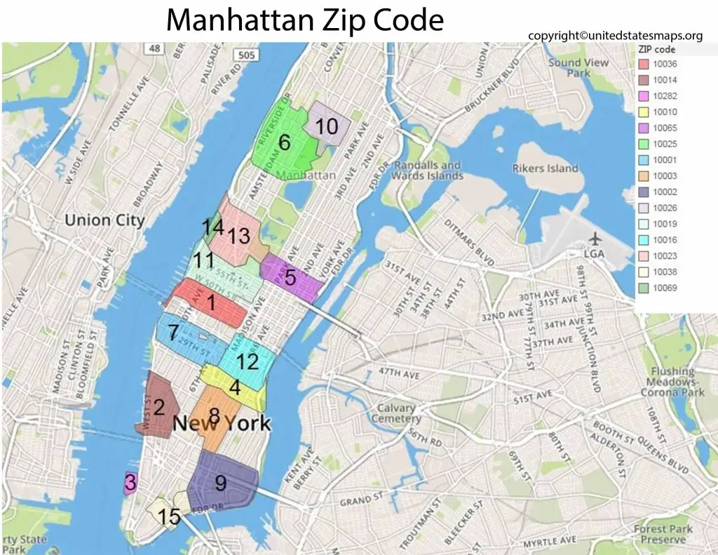
Manhattan ZIP Codes Overview
Manhattan is one of New York City’s five boroughs and has multiple zip codes that encompass neighborhoods, business districts, and landmarks. The United States Postal Service (USPS) uses these ZIP codes to ease the delivery and identification of mail.
A Manhattan ZIP Code Map helps you:
- Find ZIP code boundaries
- Locate neighborhoods quickly
- Verify mailing addresses
- Identify business districts
- Plan deliveries and travel
- Explore different areas of Manhattan
Some of the most commonly used Manhattan ZIP codes include 10001, 10002, 10003, 10004, 10005, 10006, 10007, 10009, 10010, 10011, 10012, 10013, 10014, 10016, 10017, 10018, 10019, 10021, 10022, 10023, 10024, 10025, 10026, 10027, 10028, and 10029.
Manhattan Neighborhood ZIP Codes
Each neighborhood in Manhattan has at least one and can have more than one ZIP code. A quick reference chart is located below.
| Neighborhood | Common ZIP Codes | Upper East Side | 10021, 10028, 10065, 10075 | Upper West Side | 10023, 10024, 10025 | Harlem | 10026, 10027, 10030, 10037 | Midtown Manhattan | 10001, 10016, 10017, 10018, 10019, 10022 | Chelsea | 10001, 10011 | SoHo | 10012, 10013 | Tribeca | 10007, 10013 | Greenwich Village | 10003, 10011, 10012 | Financial District | 10004, 10005, 10006, 10038 | Chinatown | 10002, 10013 | East Village | 10003, 10009 | West Village | 10014 | Lower Manhattan | 10004, 10005, 10006, 10007, 10038 |
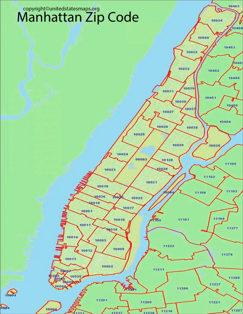
Manhattan ZIP Code Map with Streets
A Manhattan ZIP Code Map with Streets includes more detail, including major avenues and streets, highways, bridges, neighborhood names, and the boundaries of the ZIP Codes. This version is particularly convenient for navigating, planning delivery, researching real estate, and searching local businesses.
The detailed street map will normally contain the following information:
- ZIP code boundaries
- Main roads and streets of honour
- Neighborhood names
- Parks and rivers
- Bridges and tunnels
- Important landmarks
This is a street-level version of the map if you need to see something at a street level other than a postal map.
Printable Manhattan ZIP Code Map PDF
For offline reference, print out the Manhattan ZIP Code Map PDF. Useful for classrooms, office use, business planning, travel, and personal reference, a downloadable PDF of the document is useful. It can be printed onto standard-sized paper, so it can be kept at your desk or as a standard part of project paperwork.
Printable Manhattan ZIP Code Map PDF
Central Park ZIP Code
A lot of users look for the Central Park ZIP Code, but there is no one ZIP code for Central Park. Rather, there are a number of ZIP codes, depending on which entrance or nearby neighborhood you go to.
Nearly all of the area around Central Park is served by the following common ZIP codes:
- 10022
- 10023
- 10024
- 10025
- 10028
- 10029
These zip codes are east and west of the park.
Lower Manhattan ZIP Code
Lower Manhattan comprises the Financial District, Wall Street, Battery Park, Civic Center, and surrounding neighborhoods. The following are some of the most common zip codes in this area:
- 10004
- 10005
- 10006
- 10007
- 10038
Businesses, government offices, residential buildings, and tourist attractions are all typical users of these postal codes.
Why Use a Manhattan ZIP Code Map?
You can use a Manhattan ZIP Code Map for a variety of things, such as:
- The right mailing Zip code
- Identifying neighborhood boundaries
- Planning travel routes
- In-depth research on real estate and property.
- Projects in school and university.
- Business location planning
- Delivery and logistics
- A reference for emergencies or public service.
The map makes it easy, fast, and accurate to find postal areas across Manhattan, whether you’re a resident, a visitor or a business owner.
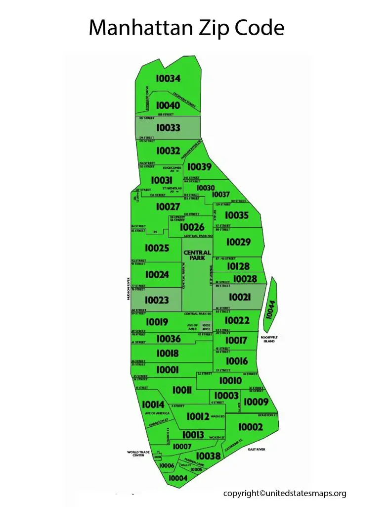
Related Maps
These maps might be useful as well:
- Houston Zip Code Map
- Las Vegas Zip Code Map
- Chicago Zip Codes Map
- California Zip Code Map
- Georgia Zip Code Map
- Texas Zip Code Map
A Manhattan ZIP Code Map shows the postal ZIP Code areas across Manhattan, New York City. It is useful for identifying neighborhoods, mailing addresses, businesses, residential areas, and local services. New York City publishes official ZIP Code maps, although some small or P.O. Box ZIP Codes may not appear on every map.
📍 What a Manhattan ZIP Code Map Shows
- ZIP Code boundaries across Manhattan.
- Neighborhoods associated with different ZIP Codes.
- Major streets and avenues.
- Central Park and other major landmarks.
- Hudson River and East River areas.
- Business and residential districts.
- Postal service areas.
- Community district boundaries.
- Major transportation and commercial locations.
- Selected P.O. Box and special-use ZIP Codes.
The official Manhattan map notes that ZIP Code boundaries and community-board boundaries are different geographic systems.
🗺️ Major Manhattan ZIP Codes
Some commonly used Manhattan ZIP Codes include:
- 10001 – Midtown/Herald Square area
- 10002 – Lower East Side
- 10003 – East Village/Union Square area
- 10004 – Financial District/Battery Park area
- 10005 – Financial District
- 10006 – Financial District
- 10007 – Civic Center/Tribeca area
- 10009 – East Village/Alphabet City
- 10010 – Gramercy/Murray Hill area
- 10011 – Chelsea
- 10012 – SoHo/NoHo/Greenwich Village area
- 10013 – Tribeca/SoHo
- 10014 – West Village
- 10016 – Murray Hill/Kips Bay
- 10017 – Midtown East
- 10018 – Garment District
- 10019 – Midtown/Columbus Circle area
- 10020 – Rockefeller Center area
- 10021 – Upper East Side
- 10022 – Midtown East
- 10023 – Upper West Side
- 10024 – Upper West Side
- 10025 – Upper West Side/Morningside Heights
- 10027 – Harlem/Morningside Heights
- 10028 – Upper East Side
- 10029 – East Harlem
- 10030 – Central Harlem
- 10031 – Hamilton Heights
- 10032 – Washington Heights area
- 10034 – Inwood
- 10036 – Times Square/Hell’s Kitchen
- 10038 – Financial District/Seaport
- 10040 – Washington Heights/Inwood
- 10128 – Upper East Side
- 10280 – Battery Park City
- 10282 – Battery Park City/World Trade Center area
NYC health and other municipal datasets also use Manhattan ZIP Codes for geographic reporting.
🏙️ Manhattan Neighborhoods by ZIP Code
A Manhattan ZIP Code Map with neighborhoods can help users understand how postal areas relate to well-known parts of Manhattan.
- Financial District
- Tribeca
- SoHo
- Chinatown
- Lower East Side
- Greenwich Village
- East Village
- West Village
- Chelsea
- Flatiron District
- Gramercy
- Union Square
- Midtown
- Hell’s Kitchen
- Times Square
- Murray Hill
- Kips Bay
- Upper East Side
- Upper West Side
- Harlem
- East Harlem
- Washington Heights
- Inwood
ZIP Codes do not always perfectly match neighborhood boundaries, so a neighborhood should not automatically be treated as having only one ZIP Code.
📮 ZIP Codes and Postal Services
The Manhattan ZIP Code map is particularly useful for understanding USPS delivery areas.
For example, the United States Postal Service location at 421 8th Avenue uses ZIP Code 10001. NYC’s Community Board 4 map also identifies several special postal ZIP Codes, including 10116, 10113, 10101, and 10108.
🏢 Business and Commercial Areas
A Manhattan ZIP Code map for businesses can help identify the postal areas of major commercial districts such as:
- Midtown Manhattan
- Financial District
- Times Square
- Garment District
- Chelsea
- SoHo
- Flatiron District
- Hudson Yards
- Union Square
- Upper East Side
Businesses can use ZIP Codes for local marketing, service-area planning, mailing campaigns, and customer segmentation.
🏠 Residential Areas
The map is also useful for understanding Manhattan’s residential geography.
- Upper East Side
- Upper West Side
- Greenwich Village
- West Village
- Chelsea
- Harlem
- East Harlem
- Washington Heights
- Inwood
- Lower East Side
- Battery Park City
🎓 Schools and Universities
A Manhattan ZIP Code map with schools can help users locate educational institutions according to their postal area.
It can be useful for:
- Public schools
- Private schools
- Colleges
- Universities
- Libraries
- Educational centers
- School district research
ZIP Codes are useful for location research, but school enrollment zones and school districts may use boundaries that differ from ZIP Code boundaries.
🏥 Hospitals and Healthcare
A Manhattan ZIP Code map with hospitals can help organize healthcare facilities geographically.
It can be used to locate:
- Hospitals
- Medical centers
- Clinics
- Urgent-care facilities
- Pharmacies
- Dental offices
- Specialist medical practices
For healthcare research, users should verify the exact address because ZIP Code boundaries do not necessarily correspond to hospital service areas.
⛪ Churches and Religious Places
A Manhattan ZIP Code map can also help users search for religious institutions by postal area, including:
- Churches
- Cathedrals
- Synagogues
- Mosques
- Temples
- Other religious centers
Examples of well-known religious landmarks include St. Patrick’s Cathedral, Trinity Church, and other historic houses of worship throughout Manhattan.
🚇 Transportation
ZIP Code maps can be combined with transportation information to understand access to:
- Subway stations
- Bus routes
- Penn Station
- Grand Central Terminal
- PATH connections
- Ferry terminals
- Major avenues
- Bridges and tunnels
🗺️ Uses of a Manhattan ZIP Code Map
- Find the ZIP Code for a Manhattan address.
- Identify the approximate postal area of a neighborhood.
- Plan local delivery services.
- Organize business locations by ZIP Code.
- Support local SEO and geographic marketing.
- Research residential areas.
- Find nearby schools and healthcare facilities.
- Understand Manhattan’s postal geography.
- Plan direct-mail campaigns.
- Analyze customers by ZIP Code.
- Research real estate markets.
- Organize service areas for local businesses.
- Understand the relationship between ZIP Codes and community districts.
Conclusion
The Manhattan ZIP Code Map is a valuable resource for finding postal boundaries, neighborhoods, and major streets across New York City’s most well-known borough. Whether you’re searching for Manhattan ZIP codes, a Manhattan ZIP Code Map with streets, a Printable Manhattan ZIP Code Map PDF, or information about Central Park and Lower Manhattan ZIP codes, this page provides a convenient reference in one place. You can also explore related maps, including the NYC ZIP Code Map and Brooklyn ZIP Code Map, for a broader view of postal areas across New York City.
Frequently Asked Questions
What is the zip code of Manhattan?
Manhattan does not have one postal code, but many. The most popular range is 10001 and is found in areas across the borough.
How many ZIP codes are in Manhattan?
There are over 40 different zip codes designated in Manhattan for residential, commercial, and special delivery services.
Which of the following is the ZIP code for Central Park?
Central Park is bordered by several ZIP codes, including 10022, 10023, 10024, 10025, 10028, and 10029.
So, what is the ZIP code for Lower Manhattan?
Lower Manhattan includes ZIP codes such as 10004, 10005, 10006, 10007, and 10038.
I’d like to get a Manhattan ZIP Code Map that I can print out.
Yes. Printable PDF version is perfect for the classroom, office, travel planning, and offline reference.
Are streets included in the Manhattan ZIP Code Map?
Yes. The Expanded version contains more detailed information, including major streets, avenues, neighborhood names, parks, and ZIP code boundaries.