Experience the history and beauty of the Old Dominion State with our interactive Virginia County Map. From the colonial charm of Williamsburg to the cosmopolitan city of Richmond, Virginia is a state full of culture and natural wonders. With our detailed map, you can discover the cities and towns of each county and plan your next Virginia adventure.
Virginia County Map
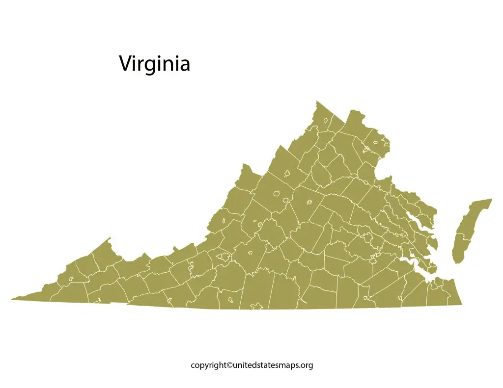
Virginia is a southeastern state in the United States of America that is known for its rich history, beautiful landscapes, and bustling cities. The state is divided into 95 counties and 38 independent cities, each with its own unique culture and identity. A Virginia County Map is a valuable tool for anyone looking to explore the state’s diverse geography, from the scenic Blue Ridge Mountains to the sandy beaches of the Eastern Shore.
The southeastern part of the United States has the lovely state of Virginia. It features a variety of landscapes, a rich cultural heritage, and thriving communities. Having a county map on hand can be quite beneficial for anyone who are thinking about moving to Virginia or visiting the state. Check other Virginia map:- Blank Virginia Map.
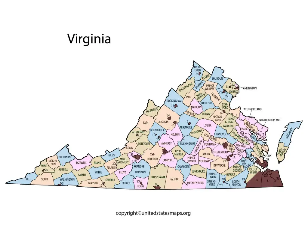
The Virginia County Map shows all the counties that make up this great state as well as their respective boundaries, names and locations. With this map at hand, one can easily navigate through the different regions of Virginia, locate cities or towns within each county and even discover new attractions worth exploring.
Whether you’re looking for outdoor adventure in Shenandoah National Park or historical landmarks in Richmond or Williamsburg, having a Virginia County Map will help you get there faster and easier. You’ll also find it useful when planning road trips across the state or trying to locate nearby amenities such as gas stations, restaurants or hotels.
County Map of Virginia
The Map of Virginia Counties is an essential resource for anyone looking to explore the state’s many attractions. The map shows the location of each of Virginia’s counties, as well as its major cities and towns. Visitors can use the map to plan a road trip, find local attractions and landmarks, and get a sense of the state’s unique geography. Some of the most popular attractions in Virginia include Colonial Williamsburg, the Shenandoah National Park, and the Virginia Aquarium & Marine Science Center.

The County Map of Virginia is a detailed representation of the state’s political and administrative divisions. The map shows the boundaries of each of Virginia’s 95 counties and their respective county seats. Some of the largest counties in Virginia include Fairfax County, Prince William County, and Loudoun County, while some of the smallest include Bath County, Highland County, and Craig County.
The Virginia City County Map is a valuable resource for anyone planning a trip to the state’s many vibrant cities. The map shows the location of each of Virginia’s 38 independent cities, as well as their respective counties. Some of the most popular cities in Virginia include Virginia Beach, Richmond, Roanoke, and Newport News, each with its own unique blend of culture, history, and attractions.
Virginia Map with Counties
The County Map Virginia with Cities is a useful tool for anyone planning a trip to the state. The map shows the location of each of Virginia’s 95 counties, as well as its major cities and towns. Some of the largest cities in Virginia include Virginia Beach, Norfolk, Chesapeake, and Richmond, while some of the smaller towns include Blacksburg, Farmville, and Warrenton.
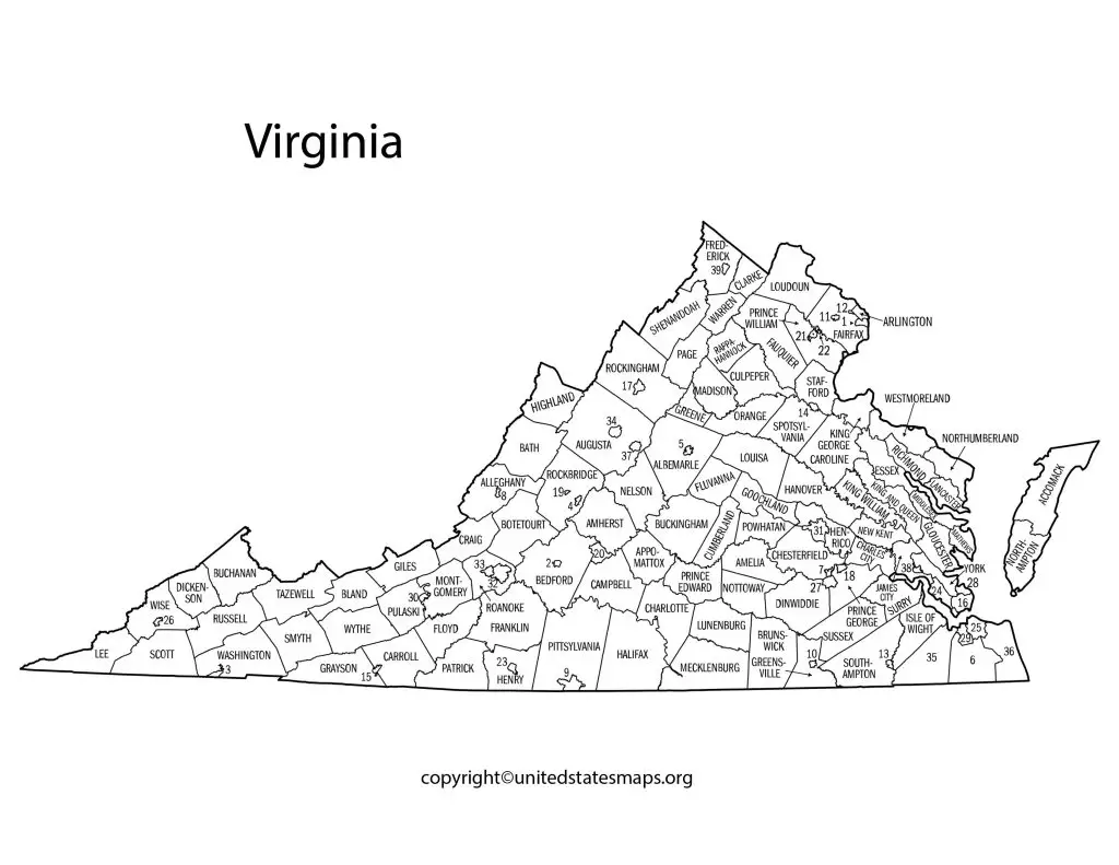
The Counties in Virginia Map is a detailed representation of the state’s many political and administrative divisions. The map shows the location of each of Virginia’s 95 counties, as well as its major cities and towns. Visitors can use the map to explore the unique culture and history of each county, from the rolling hills of Albemarle County to the historic architecture of Alexandria.
The Virginia Map with Counties is an excellent resource for anyone who wants to explore the state’s many attractions. The map shows the location of each of Virginia’s counties, as well as its major cities and towns. Visitors can use the map to plan a road trip, find local attractions and landmarks, and get a sense of the state’s unique geography.