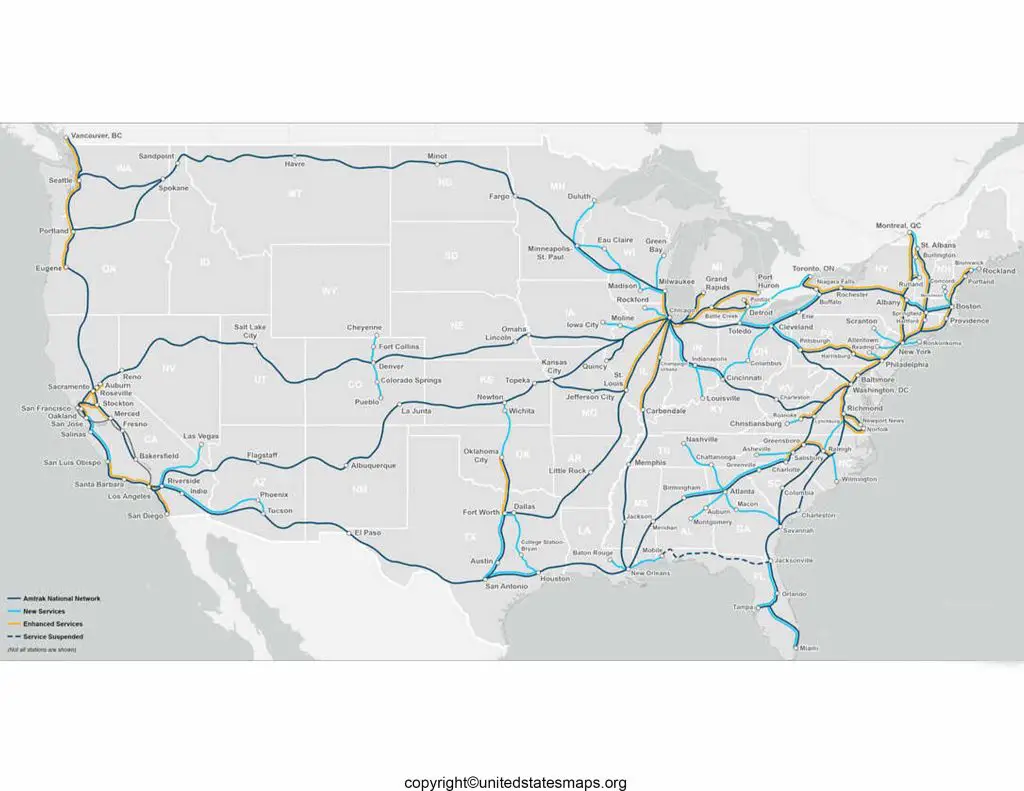
The United States has an extensive and intricate railway network that spans across various states and connects major cities, ports, and industrial hubs. The railway system in the USA has a rich history, playing a pivotal role in the country’s economic growth and transportation infrastructure. A map of railways in USA, commonly known as the United States Railway Map, provides a comprehensive visual representation of the country’s rail network, showcasing the intricate web of tracks and routes that facilitate the movement of passengers and freight. This article delves into the significance of the railway system in the USA and the value of utilizing a detailed railway map for various purposes.
Map of Railways in USA
The United States boasts an extensive and intricate railway network that spans across the country, connecting major cities, rural areas, and everything in between. A map of the railways in the USA showcases this vast transportation system, highlighting the various routes, junctions, and key hubs that keep the nation moving. Let’s delve into the details of this remarkable railway infrastructure.
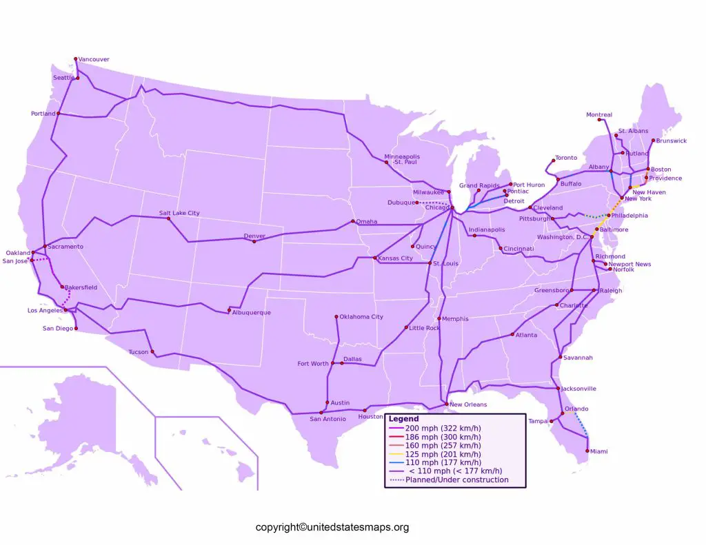
Starting on the East Coast, one can observe a dense network of railways that serves the populous northeastern region. Major cities like Boston, New York City, Philadelphia, and Washington, D.C. are interconnected by a web of railway lines, ensuring efficient transportation for both passengers and freight. The iconic Amtrak Northeast Corridor runs along this stretch, offering high-speed train services and connecting travelers from Boston all the way down to the capital.
As we move westward, the railway lines branch out, stretching across the vast expanse of the Midwest and Great Plains. Cities like Chicago, known as the “hub of the nation,” act as pivotal points where multiple railway lines intersect. From here, one can venture north to Minneapolis, south to St. Louis, or west to Denver and beyond. These routes not only facilitate regional travel but also provide crucial connections to the western states.
The US railway map then takes us to the western United States, where the landscape poses unique challenges for railway engineers. Mountains, canyons, and deserts require ingenious engineering solutions. The California Zephyr, for example, traverses the breathtaking Rocky Mountains, offering passengers stunning views as they journey from Chicago to San Francisco. Check out more Railway Maps:- Canadian Pacific Railway Map, Open Railway Map, BNSF Railway Map.
United States Railway Map
The USA railway map offers a comprehensive visual representation of the extensive railway network that spans the entire United States. This map provides an overview of the various railway lines, junctions, and connections that crisscross the nation, showcasing the crucial role of railways in facilitating transportation, trade, and economic development. Let’s delve into the details of this remarkable railway map.
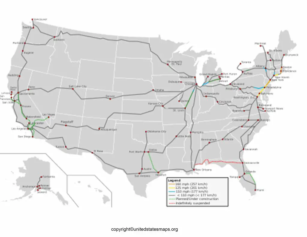
Starting on the East Coast, the railway lines radiate outwards, connecting major cities such as Boston, New York City, Philadelphia, and Washington, D.C. These routes form the backbone of the northeastern corridor, a densely populated region where millions of commuters rely on railways for their daily commute. The Amtrak Northeast Corridor, running along this stretch, offers high-speed train services, reducing travel times and providing a convenient alternative to air and road travel.
Moving westward, the railway map reveals the extensive network that spans the heartland of America. Cities like Chicago, known as the “Railroad Capital of the World,” act as vital hubs where multiple railway lines converge. From here, railways branch out in all directions, connecting regions such as the Great Lakes, the Mississippi River Valley, and the vast expanse of the Great Plains. These routes facilitate the movement of goods and resources, playing a crucial role in supporting industries such as agriculture, manufacturing, and energy.
The western United States presents unique challenges for railway engineers, with its rugged terrain and geographic barriers. Yet, the railway map showcases remarkable engineering achievements, such as the Transcontinental Railroad, which connected the East Coast with the West Coast in the late 19th century. Today, railway lines traverse the Rocky Mountains, the Sierra Nevada, and the deserts of the Southwest, enabling efficient transportation across states like California, Colorado, and Arizona.
US Railway System Map
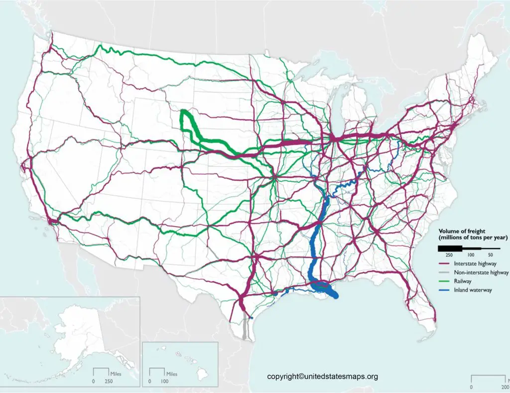
The map of US railways provides a comprehensive view of the intricate network of railroads that spans the United States. This detailed map showcases the extensive railway system, highlighting the various routes, junctions, and connections that allow for the efficient transportation of people and goods throughout the nation. Let’s explore the key features of this remarkable map.
Starting from the eastern part of the United States, the railway system extends along the densely populated Northeast Corridor. This region is characterized by a high concentration of railway lines connecting major cities such as Boston, New York City, Philadelphia, and Washington, D.C. The Amtrak Northeast Corridor, with its high-speed train services, forms a crucial link, providing a convenient and sustainable transportation option for commuters traveling between these metropolitan areas.
Moving westward, the railway system expands across the heartland of America, covering states such as Ohio, Illinois, and Kansas. Key railway junctions, including Chicago, serve as vital hubs where multiple rail lines converge. From these junctions, railways extend in various directions, connecting regions such as the Great Lakes, the Mississippi River Valley, and the Great Plains. These routes support the transportation of goods, fostering economic growth in industries such as agriculture, manufacturing, and energy.
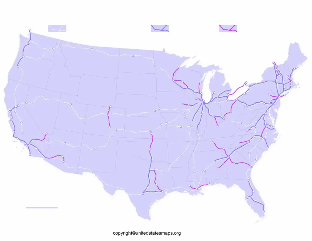
The western part of the US railway system poses unique challenges due to its diverse geography. Railway lines traverse the majestic Rocky Mountains, overcoming steep grades and winding through scenic landscapes. Major routes like the California Zephyr offer breathtaking views as they journey from Chicago to the
Pacific Coast, passing through states such as Colorado, Utah, and Nevada. In the southwest, railways navigate through arid deserts and connect cities like Los Angeles, Phoenix, and Albuquerque, supporting regional trade and tourism.