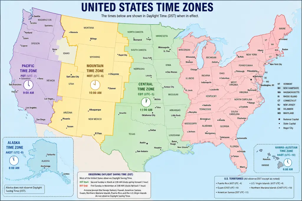
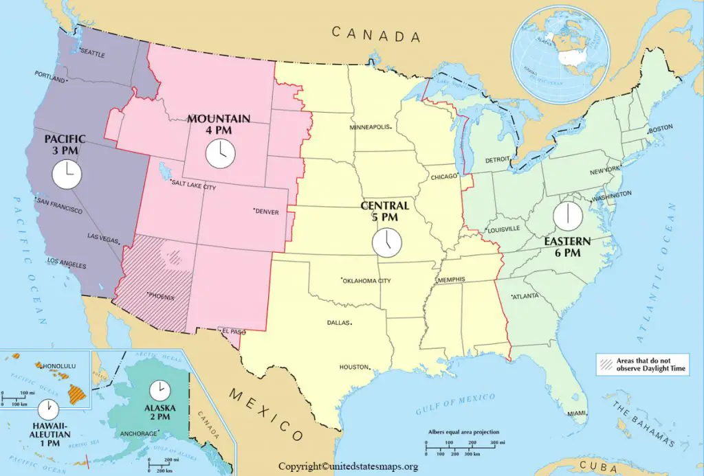
Looking for an accurate US Time Zone Map? This is an updated version of the map showing all major time zones in the United States, including Eastern, Central, Mountain, Pacific, Alaska, and Hawaii-Aleutian Time. This printable US time zone map covers everything from planning trips and cross-state meetings to tracking time differences and researching US geography.
There are several time zones in the U.S. because it is a large country. Time zones are essential for travelers, businessmen, students, teleworkers, and logistics professionals to understand. This USA time zone map contains state boundaries, major cities, daylight saving time, and current time zone references.
Quick Navigation
US Time Zones at a Glance
| Time Zone | UTC Offset | Abbreviation |
|---|---|---|
| Eastern Time | UTC -5 | EST |
| Central Time | UTC -6 | CST |
| Mountain Time | UTC -7 | MST |
| Pacific Time | UTC -8 | PST |
| Alaska Time | UTC -9 | AKST |
| Hawaii-Aleutian Time | UTC -10 | HST |
Why Does the United States Have Multiple Time Zones?
Before the introduction of standard time, communities and cities in America kept to their local solar time. Different local times became impractical because of the railroads, telegraphs, and interstate commerce. Time zones were established in the country to ensure uniformity in time.
Today, U.S. time zones help coordinate transportation, business operations, television broadcasts, online meetings, and travel schedules.
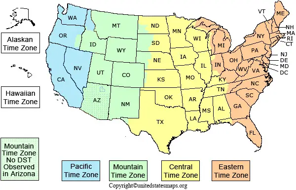
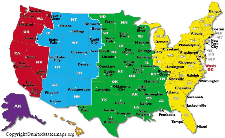
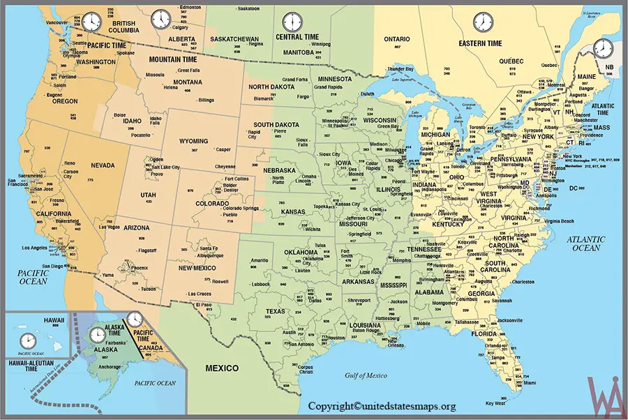
States by US Time Zone Map
States by US Time Zone PDF
Eastern Time Zone States
- New York
- Florida
- Georgia
- Pennsylvania
- Ohio
- Virginia
- North Carolina
- South Carolina
- New Jersey
- Connecticut
- Massachusetts
- Rhode Island
- Vermont
- New Hampshire
- Maine
- Maryland
- Delaware
- West Virginia
Central Time Zone States
- Texas
- Illinois
- Alabama
- Arkansas
- Louisiana
- Mississippi
- Wisconsin
- Minnesota
- Oklahoma
- Kansas
- Iowa
- Missouri
- Nebraska
- North Dakota
- South Dakota
- Tennessee
- Kentucky
Mountain Time Zone States
- Colorado
- Montana
- Wyoming
- Utah
- New Mexico
- Arizona
- Idaho
- Oregon
- Nevada
Pacific Time Zone States
- California
- Washington
- Oregon
- Nevada
Related US Maps
- Voting Map
- Climate Map
- Pipeline Map
- Coronavirus US Map
- Geographical Map of the USA
- US Surface Weather Map
States with Multiple Time Zones
Several U.S. states observe more than one time zone. These include:
- Florida
- Texas
- Oregon
- Idaho
- Tennessee
- Kentucky
- Alaska
- Nebraska
- Kansas
- South Dakota
These states are frequently searched by travelers, truck drivers, businesses, and remote teams working across different regions.
US Time Difference Chart
| From | To | Difference |
|---|---|---|
| EST | CST | 1 Hour |
| EST | MST | 2 Hours |
| EST | PST | 3 Hours |
| CST | MST | 1 Hour |
| CST | PST | 2 Hours |
| MST | PST | 1 Hour |
Daylight Saving Time in the United States
Most U.S. states observe Daylight Saving Time (DST), which shifts clocks forward in spring and back in fall to maximize daylight hours.
However, the following regions do not observe DST:
- Hawaii
- Most of Arizona
- American Samoa
- Guam
- Northern Mariana Islands
- Puerto Rico
- U.S. Virgin Islands
Understanding daylight saving time is important when scheduling flights, virtual meetings, and business calls across multiple states.
Major U.S. Cities and Their Time Zones
| City | Time Zone |
|---|---|
| New York | Eastern Time |
| Miami | Eastern Time |
| Chicago | Central Time |
| Dallas | Central Time |
| Denver | Mountain Time |
| Phoenix | Mountain Time |
| Los Angeles | Pacific Time |
| Seattle | Pacific Time |
| Anchorage | Alaska Time |
| Honolulu | Hawaii Time |
Printable US Time Zone Map
Our printable US time zone map is useful for:
- Schools and classrooms
- Geography projects
- Travel planning
- Logistics and transportation
- Business scheduling
- Office reference materials
Maps are available in PDF, PNG, and JPG formats for easy printing and downloading.
Conclusion
The new United States Time Zone Map allows users to easily locate time zone boundaries, calculate time zone differences, determine DST, and find the right zone for any state or city. This map of the United States is available in printable format, with time zones, a time zone chart, and a U.S. time zone guide—all accurate and easy to understand for daily use.
FAQs US Time Zone Map
How many time zones are there in the United States?
The United States uses six primary time zones across the 50 states and additional time zones in U.S. territories.
Which state has the most time zones?
Alaska spans multiple time zones and covers a vast geographic area.
Does Arizona observe Daylight Saving Time?
Most of Arizona does not observe Daylight Saving Time.
Does Hawaii change its clocks?
No. Hawaii remains on standard time throughout the year.
What time zone is California in?
California follows Pacific Time (PT).
What time zone is Texas in?
Most of Texas follows Central Time, while parts of western Texas observe Mountain Time.